Other ID: none
Status: Completed
Organization(s): USGS, Woods Hole Coastal and Marine Science Center
Funding Program(s):
Principal Investigator(s): Rafael W. Rodriguez
Affiliate Investigator(s):
Information Specialist(s):
Data Type(s): Sampling: Geology, Sampling: Biology, Environmental Data: Turbidity, Sampling: Chemistry, Location-Elevation: Navigation
Scientific Purpose/Goals: Determine bottom-sediment distribution, suspended-sediment concentration, water color, transparency, and salinity in the Mayaguez-Boqueron area, offshore southwestern Puerto Rico.
Vehicle(s):
Start Port/Location:
End Port/Location:
Start Date: 1976-01-18
End Date: 1976-02-26
Equipment Used: Shipek grab, Van Veen grab sampler, Smith-MacIntyre grab, Secchi disk, Water sampler, Raytheon radar
Information to be Derived: Samples and chemical analysis; Grain size analysis;
Summary of Activity and Data Gathered: In shallow areas a 17-foot McKee and a 10-1/2 foot inflatable Zodiac were used. Navigation in small boats was usually by horizontal sextant angles. With a 1:20,000 scale, 2 meter contour interval bathymetric map as a guide, 158 bottom samples were collected. Additional strategic samples will be collected following preliminary microscope examination of these.
Staff: Rafael W. Rodriguez, Jose R. Muniz, Nelson Espinell
Affiliate Staff:
Notes:
Location:
Mayaguez, Boqueron, Puerto Rico, Caribbean Sea, United States, North America, North Atlantic;
| Boundaries | |||
|---|---|---|---|
| North: 18.3 | South: 17.975 | West: -67.35 | East: -67.175 |
Platform(s):
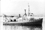
 Jean A |
| Title | Survey Equipment | Description |
|---|---|---|
| Cruise report | (document not focused on specific equipment) | Chief Scientist's cruise report of ship movement, personnel, equipment and data acquisition. Includes location map of areas and sampling sites. |
| Survey Equipment | Survey Info | Data Type(s) | Data Collected |
|---|---|---|---|
| Shipek grab | --- | Geology | |
| Van Veen grab sampler | --- | Geology | |
| Smith-MacIntyre grab | --- | Biology Geology | |
| Secchi disk | --- | Turbidity | |
| Water sampler | --- | Chemistry | |
| Raytheon radar | --- | Navigation |