Other ID: FAY 017
Status: Completed
Organization(s): USGS, Woods Hole Coastal and Marine Science Center
Funding Program(s):
Principal Investigator(s): William Dillon
Affiliate Investigator(s):
Information Specialist(s):
Data Type(s): Electro-Magnetic: Gravity, Electro-Magnetic: Magnetics, Location-Elevation: Navigation, Seismics: Air Gun / Water Gun, Seismics: Sparker, Seismics: Sub Bottom Profiler
Scientific Purpose/Goals: Geophysical reconnaissance of southeast Georgia Embayment.
Vehicle(s):
Start Port/Location: Fort Lauderdale, FL
End Port/Location: Charleston, SC
Start Date: 1976-06-20
End Date: 1976-06-29
Equipment Used: Air gun, Del Norte 26 sparker, 3.5 kHz, Gravity meter (wh), Marine magnetometer, Integrated Navigation System, Single channel hydrophone
Information to be Derived: Morphology;
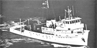
Summary of Activity and Data Gathered: FAY sailed from Ft. Lauderdale at noon on June 20, 1976. All systems began operation on June 21, 1976 at 0800 and continued until June 29, 1976 at 0800. One tie line was run along the shelf from Daytona Beach to Cape Fear, then 8 cross-shelf lines were obtained between Cape Fear and Charleston, spaced about 30 km apart. These lines were about 160 km long, extending from shallow water (10 m) to 600 m on the inner Blake Plateau. Average operating speed was about 6.5 kts. Due to a 4-day delay, the survey of a possibly active fault on the outer edge of the Blake Plateau was postponed until fall. The relatively high operating speed and generally excellent weather allowed us to make up some lost time. The sparker system produced excellent high-resolution records and the airgun system was adjusted for a relatively high-frequency bandpass (32 - 205 Hz) to improve resolution. No apparent loss of penetration could be noted with this high bandpass. The addition of the 160 cu. in. airgun to the 3 small guns did not appear to change gun signature but did increase power, so the 4 guns were run together for the remainder of the cruise. The FAY was an exceptionally well run, well maintained ship under Captain Olander and Chief Engineer Weeks, and we received excellent cooperation throughout the cruise from all the officers and crew members. Seismic profiles: 2000 km; Magnetics: 2000 km; Gravity: 2600 km.
Staff: William Dillon, Deborah Hutchinson, Frank W. Jennings, Perry Parks, Charles Paull, Elizabeth Winget
Affiliate Staff:
Caroline Morse - seismic watch
Douglas Edsall - seismic watch
Felicity Oram - seismic tech.
Donald Moller - nav./grav.
Prescott Heald - nav./grav.; John Redman - seismic watch
BLM; Alan-Jon Zupan - seismic watch
South Carolina Geological Survey; Paul Bereznak - nav./grav.
Western Geophysical
Notes: Original Center People field contained: Bill Dillon - Ch. Sci.; Debbie Hutchinson - seismic watch, Caroline Morse - seismic watch, Douglas Edsall - seismic watch, Elizabeth Winget - seismic watch, Frank Jennings - seismic tech., Felicity Oram - seismic tech., Perry Parks - nav./grav., Donald Moller - nav./grav., Prescott Heald - nav./grav., Charles Paull - nav./grav. and cruise curator.
Location:
outer continental shelf, inner Blake Plateau, Florida, Georgia, South Carolina, North Carolina, United States, North America, North Atlantic;
| Boundaries | |||
|---|---|---|---|
| North: 34 | South: 28.5 | West: -81.75 | East: -76.5 |
Platform(s):
 Fay |
Paskevich, V.F., and Soderberg, N.K., 1997, Navigation and geophysical data collected onboard the R/V Fay from 1975-1976: U.S. Geological Survey Open-File Report 97-512, CD-ROM, URL: https://doi.org/10.3133/ofr97512.
Popenoe, P., 1991, Maps and cross sections depicting the shallow seismic stratigraphy of the continental shelf and slope off Georgia from interpretation of high-resolution seismic-reflection data: U.S. Geological Survey Open-File Report (91-397), 35 p., https://doi.org/10.3133/ofr91397.
Popenoe, P., and Manheim, F.T., 2001, Origin and history of the Charleston Bump--geological formations, currents, bottom conditions, and their relationship to Wreckfish habitats on the Blake Plateau, in Sedberry, G.R., ed., Island in the Stream--Oceanography and Fisheries of the Charleston Bump: American Fisheries Society Symposium, v. 25.
Popenoe, P., and Spalding, J.S., 1988, Isopach and structure contour maps of the Miocene and post-Miocene sediments in the southeast Georgia Embayment, Florida-Hatteras Shelf, offshore Georgia: U.S. Geological Survey Open-File Report 88-397, 12 p., https://doi.org/10.3133/ofr88397.
| Title | Survey Equipment | Description |
|---|---|---|
| Cruise report | (document not focused on specific equipment) | Chief Scientist's daily log of ship movement, equipment and data acquisition notes, personnel activities, and trackmap. |
| Geophysics log | (document not focused on specific equipment) | Watchstanders' geophysical daily log for 160 cubic inch airgun, minisparker, 3.5 kHz systems and gradiometer with data acquisition remarks. Lined-notebook sheets loose and 63 images from two-sided logform. |
| Survey Equipment | Survey Info | Data Type(s) | Data Collected |
|---|---|---|---|
| Air gun | --- | Air Gun / Water Gun | |
| Del Norte 26 sparker | --- | Sparker | |
| 3.5 kHz | --- | Sub Bottom Profiler | 1976-020-FA-BA-001 (Digital tape(s) of NV, GR, BT-FINAL, GR,BT-FINAL, MG, GR-FINAL, MX-FINAL, NV-INS-FINAL, ) |
| Gravity meter (wh) | --- | Gravity | 1976-020-FA-GP-002 (Digital tape(s) of NV, GR, BT-FINAL, GR,BT-FINAL, MG, GR-FINAL, MX-FINAL, NV-INS-FINAL, ) |
| Marine magnetometer | --- | Magnetics | 1976-020-FA-GP-001 (Digital tape(s) of NV, GR, BT-FINAL, GR,BT-FINAL, MG, GR-FINAL, MX-FINAL, NV-INS-FINAL, ) |
| Integrated Navigation System | --- | Navigation | 1976-020-FA-LN-001-03 (Northern Track Map (pdf) Trackline map for Lines 2 through 17 with hourly fixes.) 1976-020-FA-LN-001-01 (Transit Track Map (pdf) Trackline map for transit to Line 1 with hourly fixes.) 1976-020-FA-LN-001-02 (Southern Track Map (pdf) Trackline map for Line 1 with hourly fixes.) 1976-020-FA-LN-002 (Digital tape(s) of NV, GR, BT-FINAL, GR,BT-FINAL, MG, GR-FINAL, MX-FINAL, NV-INS-FINAL, ) 1976-020-FA-LN-003 (Navigation data) |
| Single channel hydrophone | --- | Air Gun / Water Gun Boomer Bubble Gun Sparker Sub Bottom Profiler | 1976-020-FA-SE-005-01 (Paper record section of Lines 1, ) 1976-020-FA-SE-001 (film collection of 3.5) 1976-020-FA-SE-002 (Collection of paper airgun and minisparker record displays of seismic data.) 1976-020-FA-SE-003 (microfilm of ) 1976-020-FA-SE-004 (analog tape of seismic data) 1976-020-FA-SE-002-01 (Digital electronic scans of some paper seismic profiles (airgun, minisparker and airgun replay).) |