Other ID: 76-1
Status: Completed
Organization(s): USGS, Woods Hole Coastal and Marine Science Center
Funding Program(s):
Principal Investigator(s): David W. Folger
Affiliate Investigator(s):
Information Specialist(s):
Data Type(s): Environmental Data: Turbidity, Imagery: Photo, Location-Elevation: Navigation, Visual Identification: Submersible Observations
Scientific Purpose/Goals: Evaluate changes in bottom configuration and biology in areas where railroad wheels and pipes were set in 1975, and search for a lost current meter array.
Vehicle(s):
Start Port/Location: Woods Hole, MA
End Port/Location: Woods Hole, MA
Start Date: 1976-07-01
End Date: 1976-07-07
Equipment Used: 35 mm camera, Montedoro Whitney transmissometer with nephelometer, Loran-A, Loran-C, Submersible Observation
Information to be Derived: Suspended sediment concentrations;
Summary of Activity and Data Gathered: At mooring site 110, where a lost current meter array was sought, heavy fog prevented an extensive search for the equipment. Railroad wheel was located and extensively photographed at station 4503. Diving operations during the whole cruise were severely restricted by heavy fog during part or all of each day. Sea conditions were most often good but visibility was not generally within operating minimums. Dives: 8 (#683, 684, 685, 686, 687, 688, 689, and 690); Stations: 2 (4502 and 4503); Transmissometer casts: 10; Hydrocasts: 6; Nephelometer: 1; Suspended matter samples: 5; XBTs: 0; Videos; Photos. Lost current meter was not located at site 110; biology surveys were successful at site 4503.
Staff: Michael Bothner, David W. Folger
Affiliate Staff:
Randy Fabro; NEKTON GAMMA pilots: R. Slater
Parsons
Czahara; VIMS: J. Kraeuter; Andrew Eliason - Consultant; Norman Vine - Consultant
Notes: Original Center People field contained: Dave Folger - Ch. Sci., Mike Bothner, Randy Fabro.
Location:
Great South Channel, Georges Bank, United States, North America, North Atlantic;
| Boundaries | |||
|---|---|---|---|
| North: 42.02753423 | South: 40.58429256 | West: -69.09851074 | East: -67.28027344 |
Platform(s):
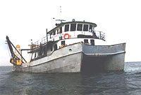 Atlantic Twin | 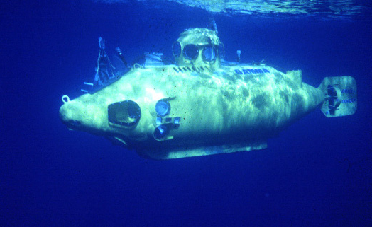 Nekton Gamma |
| Title | Survey Equipment | Description |
|---|---|---|
| Cruise report | (document not focused on specific equipment) | Chief Scientist's cruise report of ship movement, personnel, equipment performance and data acquisition, daily narrative, submersible dive log, mooring locations and dive sites. |
| Survey Equipment | Survey Info | Data Type(s) | Data Collected |
|---|---|---|---|
| 35 mm camera | --- | Photo | |
| Montedoro Whitney transmissometer with nephelometer | --- | Turbidity | |
| Loran-A | --- | Navigation | |
| Loran-C | --- | Navigation | |
| Submersible Observation | --- | Submersible Observations |
