Other ID: FAY 019
Status: Completed
Organization(s): USGS, Woods Hole Coastal and Marine Science Center
Funding Program(s):
Principal Investigator(s): John Grow
Affiliate Investigator(s):
Information Specialist(s):
Data Type(s): Seismics: Sub Bottom Profiler, Electro-Magnetic: Gravity, Location-Elevation: Navigation, Seismics: Air Gun / Water Gun, Seismics: Boomer, Seismics: Sparker, Sonar: Single Beam
Scientific Purpose/Goals: This cruise between Charleston and Norfolk concentrated on long geophysical profiles over the continental shelf, slope and rise off Cape Hatteras. Eight long profiles were collected transverse to the margin and two parallel to the margin along the rise tying into DSDP sites #105 and 106. Magnetics, gravity and minisparker data were collected along 2 transverse lines that went along previously purchased multichannel lines.
Vehicle(s):
Start Port/Location: Charleston, SC
End Port/Location: Norfolk, VA
Start Date: 1976-07-17
End Date: 1976-08-04
Equipment Used: 3.5 kHz, Seismic Engineering streamer, Air gun, Gravity meter (wh), Western Geophysical Integrated Navigation System, Echosounder
Information to be Derived: Morphology;
Summary of Activity and Data Gathered: The single-channel reflection profiles for FAY 019 were outstanding with excellent resolution of basement and the deeper Mesozoic horizons throughout the western Atlantic. Airgun: 3590 km; Gravity: 4770 km; Magnetics: 3940 km; Minisparker: 4270 km; 3.5 kHz Sonar: 680 km.
Staff: David Egelson, John Grow, Kathleen Kent, Ralph Lewis, Perry Parks, Richard E. Sylwester, Barbara Tausey
Affiliate Staff:
Rob Pexton - seismic tech.
Gerard McCarthy - seismic tech.
Felicity Oram - mech. tech.
Scott Heald - nav. watch
Claire Reimers - nav. watch
Debbie Doyle - seismic watch
Lois Tomlinson - seismic watch
Norrie Robbins - seismic watch
Notes: Original Center People field contained: John Grow - Ch. Sci., Perry Parks - nav./grav. engineer, Richard Sylwester - seismic engineer, Rob Pexton - seismic tech., Gerard McCarthy - seismic tech., Felicity Oram - mech. tech., Kathy Kent - nav. watch, Scott Heald - nav. watch, David Egelson - nav. watch, Claire Reimers - nav. watch, Ralph Lewis - seismic watch, Barbara Tausey - seismic watch/data curator, Debbie Doyle - seismic watch, Lois Tomlinson - seismic watch, Norrie Robbins - seismic watch.
Location:
Middle Atlantic Bight, Charleston, South Carolina to Norfolk, Virginia, Atlantic Continental shelf, slope and rise, United States, North America, North Atlantic;
| Boundaries | |||
|---|---|---|---|
| North: 38.07308072 | South: 30.91898115 | West: -80.00244141 | East: -68.63290691 |
Platform(s):
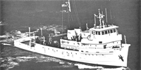
 Fay |
Bailey, N.G., and Crow J.A., 1980, Single-channel seismic-reflection profiles collected over the U.S. Atlantic continental shelf, slope, and rise east of Cape Hatteras: U.S. Geological Survey Open-File Report 1980-510, 4 p., https://doi.org/10.3133/ofr80510.
Paskevich, V.F., and Soderberg, N.K., 1997, Navigation and geophysical data collected onboard the R/V Fay from 1975-1976: U.S. Geological Survey Open-File Report 97-512, CD-ROM, URL: https://doi.org/10.3133/ofr97512.
| Title | Survey Equipment | Description |
|---|---|---|
| Cruise report | (document not focused on specific equipment) | Chief Scientist's cruise summary of ship movement, personnel, equipment and data acquisition notes. Includes trackmaps. |
| Geophysics log | (document not focused on specific equipment) | Chief Technician's description of configuration and performance of seismic equipment and data. |
| Survey Equipment | Survey Info | Data Type(s) | Data Collected |
|---|---|---|---|
| 3.5 kHz | --- | Sub Bottom Profiler | 1976-026-FA-3.5kHz_scans (TIFF images of 3.5 kHz paper records. Scanned at 300 DPI, grayscale) |
| Seismic Engineering streamer | --- | Air Gun / Water Gun Boomer Sparker | 1976-026-FA-SE-001 (film collection of CSP,MSP,AIR,NV) 1976-026-FA-SE-004 (analog tape of seismic data) 1976-026-FA-SE-003 (microfilm of ) image2segy (data at PCMSC;FAD. Please contact PCMSC_data@usgs.gov with any questions.) 1976-026-FA-SE-002 (Collection of paper airgun and minisparker record displays of seismic data.) 1976-026-FA-SE-002-01_sparker (Digital electronic scans of sparker paper seismic profiles. Scanned at 300 dpi, grayscale.) 1976-026-FA-SE-002-01_airgun (Digital electronic scans of airgun paper seismic profiles. Scanned at 300 dpi, grayscale.) 1976-026-FA-SE-002-01_replay (Digital electronic scans of paper seismic profiles - replay records. Scanned at 300 dpi, grayscale. Unsure which seismic system these represent.) 1976-026-FA-SE-002-01_rerun (Digital electronic scans of paper seismic profiles - rerun record. Scanned at 300 dpi, grayscale. Unsure which seismic system these represent.) |
| Air gun | --- | Air Gun / Water Gun | |
| Gravity meter (wh) | --- | Gravity | 1976-026-FA-GP-001 (Digital tapes of gravity and magnetics data: GR, GR-FINAL, MG, and MG-FINAL; inv. # 0923, 0936, 0945, 0967, and 1596.) |
| Western Geophysical Integrated Navigation System | --- | Navigation | 1976-026-FA-LN-002-01 (Navigation data) 1976-026-FA-LN-001-02 (Trackline Map 1 of 5 (pdf file) Trackline map for July 17-18, 1976 with hourly fixes.) 1976-026-FA-LN-001-01 (Trackline Map (pdf file) Trackline map with dates, four-hour fixes, line numbers, geologic features, equipment operation, etc.) 1976-026-FA-LN-001-03 (Trackline Map 2 of 5 (pdf file) Trackline map for July 18-26, 1976 with hourly fixes.) 1976-026-FA-LN-001-04 (Trackline Map 3 of 5 (pdf file) Trackline for map July 23, 24, and 31 and August 1-4, 1976 with hourly fixes.) 1976-026-FA-LN-001-06 (Trackline Map 5 of 5 (pdf file) Trackline map for July 27-31, 1976 with hourly fixes.) 1976-026-FA-LN-001-05 (Trackline Map 4 of 5 (pdf file) Trackline map for July 26-27, 1976 with hourly fixes. ) |
| Echosounder | --- | Single Beam | 1976-026-FA-BA-001 (Digital tapes of BT and BT-FINAL data: inv # 0945, 0946, 0961, 0967, and 0986.) |