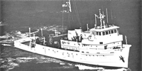
Other ID: FAY 023
Status: Completed
Organization(s): USGS, Woods Hole Coastal and Marine Science Center
Funding Program(s):
Principal Investigator(s): Robert N. Oldale
Affiliate Investigator(s):
Information Specialist(s):
Data Type(s): Electro-Magnetic: Gravity, Electro-Magnetic: Magnetics, Location-Elevation: Navigation, Seismics: Air Gun / Water Gun, Seismics: Sparker, Sonar: Single Beam
Scientific Purpose/Goals: Study the shallow sedimentary structure south and east of southern Massachusetts and study the magnetics and gravity in these areas and in the vicinity of Great South Channel and Cape Ann.
Vehicle(s):
Start Port/Location: Woods Hole, MA
End Port/Location: Woods Hole, MA
Start Date: 1976-09-12
End Date: 1976-09-17
Equipment Used: Sparker , Air gun, Marine magnetometer, Gravity meter (wh), Integrated Navigation System, Single channel hydrophone, Echosounder
Information to be Derived: Morphology;
Summary of Activity and Data Gathered: Sparker: 1200 km; Airgun: 1200 km; Magnetics: 1200 km; Gravity: 1200 km.
Staff: Dennis Edwards, Wayne Ferrebee, Barry Irwin, Kathleen Kent, Ralph Lewis, Robert N. Oldale, Perry Parks, Elizabeth Winget
Affiliate Staff:
Wallace Bothner - seismics
J. Donlavey - seismics
Nicholas Lefteriou - tech.
Donald Moller - navigation
Lin Morse - seismics
Elizabeth Winget - seismics; Paul Bereznak - navigation
Western Geophysical Corp.; James Loughlin - seismics
Manomet Wildlife Refuge
Notes: Original Center People field contained: Bob Oldale - Ch. Sci.; Wallace Mike Bothner - seismics, J. Donlavey - seismics, Dennis Edwards - tech., Wayne Mac Ferrebee - seismics, Barry Irwin - navigation, Kathleen Kent - navigation, Nicholas Lefteriou - tech., Ralph Lewis - navigation, Donald Moller - navigation, Lin Morse - seismics, Perry Parks - tech., Elizabeth Winget - seismics.
Location:
Cape Ann, Massachusetts Bay, Massachusetts, Great South Channel, Georges Bank, United States, North America, North Atlantic;
| Boundaries | |||
|---|---|---|---|
| North: 43 | South: 40 | West: -71.75 | East: -68 |
Platform(s):
 Fay |
Eskenasy, D.M., 1980, Single-channel seismic-reflection profiles from Massachusetts coastal waters and the western part of Georges Bank: U.S. Geological Survey Open-File Report 80-509, 2 p., https://doi.org/10.3133/ofr80509.
Paskevich, V.F., and Soderberg, N.K., 1997, Navigation and geophysical data collected onboard the R/V Fay from 1975-1976: U.S. Geological Survey Open-File Report 97-512, CD-ROM, URL: https://doi.org/10.3133/ofr97512.
| Title | Survey Equipment | Description |
|---|---|---|
| Cruise report | (document not focused on specific equipment) | Brief cruise memo of cruise summary, personnel list and their duties, and a simple trackmap. |
| Survey Equipment | Survey Info | Data Type(s) | Data Collected |
|---|---|---|---|
| Sparker | --- | Sparker | |
| Air gun | --- | Air Gun / Water Gun | |
| Marine magnetometer | --- | Magnetics | 1976-036-FA-GP-002 (Digital tapes of GR data: inv. # 1337.) |
| Gravity meter (wh) | --- | Gravity | 1976-036-FA-GP-001 (Digital tapes of GR data: inv. # 1337.) |
| Integrated Navigation System | --- | Navigation | 1976-036-FA-LN-001-03 (Final Track Map (pdf file) Computer-plotted track map with dates and hourly fixes.) 1976-036-FA-LN-002-01 (Navigation data) 1976-036-FA-LN-001-02 (Final Track Map (pdf file) Drafted track map with line numbers and 5 minute fixes.) 1976-036-FA-LN-001-01 (Field Track Map (pdf file) Hand-drawn field track map with line numbers and half hour ticks.) |
| Single channel hydrophone | --- | Air Gun / Water Gun Boomer Bubble Gun Sparker Sub Bottom Profiler | 1976-036-FA-SE-002 ( Collection of paper record displays of seismic data( MSP) for lines ) 1976-036-FA-SE-001 (film collection of AIR,MSP) 1976-036-FA-SE-003 (microfilm of LINES 4-19, 1-19) 1976-036-FA-SE-001-01 (Electronic scans of complete survey-paper profiles.) 1976-036-FA-SE-004 (analog tape of seismic data) |
| Echosounder | --- | Single Beam | 1976-036-FA-BA-001 (Digital tapes of BT data: inv. # 0993, 0994, 1007, and 1410.) |