Other ID: 77-02; 77-5
Status: Completed
Organization(s): USGS, Woods Hole Coastal and Marine Science Center
Funding Program(s):
Principal Investigator(s): James V. A. Trumbull
Affiliate Investigator(s): Orrin Pilkey
Information Specialist(s):
Data Type(s): Biological Field Study: Experiments (biological), Seismics: Sub Bottom Profiler, Location-Elevation: Navigation, Sampling: Geology
Scientific Purpose/Goals: Investigate submarine canyon off Rio de la Plata, north coast of Puerto Rico: coring, seismics, and bathymetry.
Vehicle(s):
Start Port/Location:
End Port/Location:
Start Date: 1977-02-14
End Date: 1977-02-16
Equipment Used: 3.5 kHz, Raytheon radar, Piston corer
Information to be Derived: Morphology;
Summary of Activity and Data Gathered: Ewing piston cores: 12; 3.5 kHz: 40 km. Cores obtained from canyon flanks and axis on shelf and slope. Flanks mostly clay with pelagic organisms but many terrigenous sand beds throughout penetration of 20 feet. Semi-indurated probably Tertiary clay and bent pipe in axial attempts. Seismic quality poor but inter-canyon sediments clearly unconformable on apparently smooth surface near axial depth of canyon. 3.5 kHz good for selecting coring locations. Bathymetry and seismics to be compiled/interpreted in San Juan. Cores stored in San Juan. Core cuts to be analyzed at Duke.
Staff: James V. A. Trumbull
Affiliate Staff:
Orrin Pilkey - USGS and Duke Univ.; Students from Duke and University of North Carolina
Notes: Project = Puerto Rico Project, Puerto Rico Project
Information from foghorn: Piston coring;
Location:
Rio de la Plata Canyon, Puerto Rico, United States, North America, North Atlantic;
| Boundaries | |||
|---|---|---|---|
| North: 18.65 | South: 18.45 | West: -66.35 | East: -66.2 |
Platform(s):
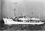 Eastward |
| Title | Survey Equipment | Description |
|---|---|---|
| Cruise report | (document not focused on specific equipment) | Brief cruise report including personnel, equipment, and comments on the results of the cruise. Combined with a tabulation of cruise data for fiscal year 1977 as part of the Puerto Rico Marine Geology Co-Op. Includes information for several field activities and a location map. |
| Survey Equipment | Survey Info | Data Type(s) | Data Collected |
|---|---|---|---|
| 3.5 kHz | --- | Sub Bottom Profiler | |
| Raytheon radar | --- | Navigation | |
| Piston corer | --- | Geology |
