Other ID: none
Status: Completed
Organization(s): USGS, Woods Hole Coastal and Marine Science Center
Funding Program(s):
Principal Investigator(s): Richard E. Sylwester
Affiliate Investigator(s):
Information Specialist(s): Nancy K. Soderberg
Data Type(s): Seismics: Sparker
Scientific Purpose/Goals: Test and evaluate equipment.
Vehicle(s):
Start Port/Location:
End Port/Location:
Start Date: 1977-04-12
End Date: 1977-04-13
Equipment Used: Sparker
Information to be Derived:
Summary of Activity and Data Gathered: All of the systems (sparker, steramer, amplifier-filter) worked extremely well and will be used on a survey in May or June on the Rhapahannock River. Additional work on the sparker will include packaging it in a waterproof container and completing the electrodeless sparker transducer.
Staff: Charles J. O'Hara, Kenneth F. Parolski, Richard E. Sylwester
Affiliate Staff:
Notes:
Location:
Massachusetts, United States, North America, North Atlantic;
| Boundaries | |||
|---|---|---|---|
| North: 42.74325 | South: 41.01307 | West: -71.3694 | East: -68.33496 |
Platform(s):
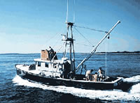
 Asterias |
| Survey Equipment | Survey Info | Data Type(s) | Data Collected |
|---|---|---|---|
| Sparker | --- | Sparker |