Other ID: none
Status: Completed
Organization(s): USGS, Woods Hole Coastal and Marine Science Center
Funding Program(s):
Principal Investigator(s): Michael Bothner
Affiliate Investigator(s):
Information Specialist(s):
Data Type(s): Sampling: Chemistry, Environmental Data: Turbidity, Environmental Data: CTD, Environmental Data: Temperature, Location-Elevation: Navigation
Scientific Purpose/Goals: Collect suspended matter and determine its nature and distribution, and measure hydrographic properties of the water column.
Vehicle(s):
Start Port/Location: Woods Hole, MA
End Port/Location: Newport, RI
Start Date: 1977-04-19
End Date: 1977-05-02
Equipment Used: Niskin bottle, Montedoro Whitney transmissometer with nephelometer, Plessey CTD, XBT, Nansen bottles, Temperature and salinity, Loran-A, Loran-C
Information to be Derived: Time series data; Suspended sediment concentrations;
Summary of Activity and Data Gathered: Full stations: 72 (including CTD, subsurface and surface salinity sample, temperature, transmissometer cast, and water samples at 3 depths). Suspended matter, nutrients, chlorophyll, Coulter counter organic-carbon, and organic nitrogen samples were taken from collected water samples. Salinity samples: 219; XBT: 89 (taken between full stations).
Staff: Michael Bothner, Sally Needell, Carol M. Parmenter, John West, Peter Johnson, Marlene Noble
Affiliate Staff:
Randy Fabro
Joan Lathrop
Nora Thom; Andrew Eliason - Eliason Data Services; Gary Parker - Raytheon; Lois Toner - WHOI
Notes: Normal operations were curtailed at 0535 April 30 when the pump circulating cooling water in the main engine failed. The alarm indicating engine overheating failed to sound and a smoldering fire began on the painted exhaust manifold. Scientific party working in the lab informed the bridge of smoke coming from the engine room and the engine was turned off. The water pump was repaired at sea but the damage caused by overheating other parts of the engine could not be repaired. The ship was adrift from the time smoke was noticed until Tug WHITEFOOT took us in tow at 0958 May 1. We arrived at dock in Newport, RI at 1305 May 2, 1977. Scientific equipment and personnel returned to Woods Hole by truck. Original Center People field contained: Mike Bothner - Ch. Sci., Randy Fabro, Peter Johnson, Joan Lathrop, Marlene Noble, Carol Parmenter, Nora Thom, John West, Sally Wood.
Location:
U.S. mid-Atlantic continental shelf, Long Island, Chesapeake Bay, United States, North America, North Atlantic;
| Boundaries | |||
|---|---|---|---|
| North: 40.75 | South: 36.75 | West: -76 | East: -72 |
Platform(s):
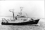 Sub Sig II |
| Title | Survey Equipment | Description |
|---|---|---|
| Cruise report | (document not focused on specific equipment) | Chief Scientist's cruise report and daily log describing ship movement, equipment and data acquisition notes, personnel, track chart, suspended matter station information, XBT-CTD-salinity station information, water chemistry sample information, bridge log. |
| Survey Equipment | Survey Info | Data Type(s) | Data Collected |
|---|---|---|---|
| Niskin bottle | --- | Chemistry | |
| Montedoro Whitney transmissometer with nephelometer | --- | Turbidity | |
| Plessey CTD | --- | CTD | |
| XBT | --- | Temperature | 1977-016-FA-NL-001 (Logs for XBT, ) |
| Nansen bottles | --- | Temperature Chemistry | |
| Temperature and salinity | --- | CTD Temperature | |
| Loran-A | --- | Navigation | |
| Loran-C | --- | Navigation |
