Other ID: none
Status: Completed
Organization(s): USGS, Woods Hole Coastal and Marine Science Center
Funding Program(s):
Principal Investigator(s): William J. Strahle
Affiliate Investigator(s):
Information Specialist(s):
Data Type(s): Imagery: Photo, Time Series: Mooring (physical oceanography)
Scientific Purpose/Goals: Deploy a tripod with an associated surface marker buoy at South Atlantic Station B as part of a continued study of sediment transport and currents along the east coast continental shelf.
Vehicle(s):
Start Port/Location: Wilmington, NC
End Port/Location: Wilmington, NC
Start Date: 1977-08-05
End Date: 1977-08-07
Equipment Used: Camera- deep sea, Bottom platform
Information to be Derived: Time series data;
Summary of Activity and Data Gathered: Deployed tripod: 1 (#134 recovered FA 77032 ADVANCE II Sep. 7-23, 1977).
Staff: William J. Strahle, John West
Affiliate Staff:
Notes: Original Center People field contained: William Strahle - Ch. Sci./e.eng.; John West - tech.
Location:
U.S. south Atlantic continental shelf, Georgia, United States, North America, North Atlantic;
| Boundaries | |||
|---|---|---|---|
| North: 31.10586117 | South: 30.98166512 | West: -80.51169239 | East: -80.38839612 |
Platform(s):
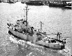 Advance II |
| Title | Survey Equipment | Description |
|---|---|---|
| Cruise report | (document not focused on specific equipment) | Chief Scientist's log of ship movement, personnel, equipment notes, and daily narrative. Also has map of tripod locations. |
| Survey Equipment | Survey Info | Data Type(s) | Data Collected |
|---|---|---|---|
| Camera- deep sea | --- | Photo | 1977-028-FA-PH-001 (film collection of TRIPOD 134; 19770806-19770908) |
| Bottom platform | --- | Mooring (physical oceanography) |
