Other ID: ANN-2-77
Status: Completed
Organization(s): USGS, Woods Hole Coastal and Marine Science Center
Funding Program(s):
Principal Investigator(s): Charles J. O'Hara
Affiliate Investigator(s): Jim Katsolis - Eastern Instrument Corporation, Norwood, NJ
Information Specialist(s):
Data Type(s): Sampling: Geology, Location-Elevation: Navigation
Scientific Purpose/Goals: The vibracore sampling program is intended to determine the nature of bottom sediments and shallow substrate on the inner shelf. The core data will be correlated with sub-bottom seismic profiling data to determine the distribution, lithology and economic significance of offshore geologic features and mineral resources. These studies will document important landmark data, help to evaluate feasibility and environmental impact of offshore mining of sand and gravel deposits and offshore disposal of solid waste material, and provide information on the geology and geologic history of the region.
Vehicle(s):
Start Port/Location: Woods Hole, MA
End Port/Location: Woods Hole, MA
Start Date: 1977-09-27
End Date: 1977-10-02
Equipment Used: Alpine Vibracorer, Epsco LORAN-C
Information to be Derived: Samples and chemical analysis; Grain size analysis;
Summary of Activity and Data Gathered: Vibracores: 20; Total feet penetrated: 459 (140 m); Total sediment recovered: 394 ft. (120 m); Percent Recovery: 86; Average core recovery per station: 19.7 ft. (6 m).
Staff: Charles J. O'Hara, John M. Aaron, Diane M. Eskenasy, Wayne Ferrebee
Affiliate Staff:
Jack McLane - geologist; Gary Clayton - biologist
MA CZM; Jim Katsolis - Field supervisor
Eastern Instrument Corp.
Notes: All Massachusetts Cooperative cores were lost in USGS Mashpee Warehouse fire, May 12, 1978. Original Center People field contained: Charles (Chuck) O'Hara - Scientist in charge; John Aaron - geologist, Diane Eskenasy - GFA, Wayne (Mac) Ferrebee - geologist, Jack McLane - geologist.
Location:
Nantucket Sound, Massachusetts, United States, North America, North Atlantic;
| Boundaries | |||
|---|---|---|---|
| North: 41.7 | South: 41.3 | West: -70.7 | East: -70 |
Platform(s):
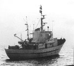 Annandale |
O'Hara, C.J., and Oldale, R.N., 1987, Maps showing geology, shallow structure, and bedform morphology of Nantucket Sound, Massachusetts: U.S. Geological Survey Miscellaneous Field Studies Map MF-1911, 4 sheets, URL: https://doi.org/10.3133/mf1911.
| Title | Survey Equipment | Description |
|---|---|---|
| Cruise report | (document not focused on specific equipment) | Chief Scientist's cruise report, vibracore locations and site map. |
| Seismic log | Alpine Vibracorer | Vibracore Logbook (pdf file) Station log with core identifiers, position, and acquisition notes. |
| Core description | Alpine Vibracorer | Vibracore Visual Core Description Logbook (pdf file) Technician's descriptions of vibracores #4920 through #4939 taken in Nantucket Sound. |
| Survey Equipment | Survey Info | Data Type(s) | Data Collected |
|---|---|---|---|
| Alpine Vibracorer | --- | Geology | 1977-035-FA-NL-001-03 (Vibracore Visual Core Description Logbook (pdf file) Technician's descriptions of vibracores #4920 through #4939 taken in Nantucket Sound. ) 1977-035-FA-NL-001-02 (Vibracore Logbook (pdf file) Station log with core identifiers, position, and acquisition notes.) 1977-035-FA-LN-001 (Vibracore Location Table (txt file) Chief Scientist's vibracore locations table.) |
| Epsco LORAN-C | --- | Navigation |
