Other ID: 77-01 or 77-4
Status: Completed
Organization(s): USGS, Woods Hole Coastal and Marine Science Center
Funding Program(s):
Principal Investigator(s):
Affiliate Investigator(s): Scripps Institution of Oceanography
Information Specialist(s):
Data Type(s): Sonar: Single Beam, Time Series: Mooring (physical oceanography), Location-Elevation: Navigation
Scientific Purpose/Goals: Recover Scripps current meter.
Vehicle(s):
Start Port/Location:
End Port/Location:
Start Date: 1977-02-18
End Date: 1977-02-18
Equipment Used: Echosounder, Current, Raytheon radar
Information to be Derived: Time series data;
Summary of Activity and Data Gathered: Successfully recovered current meter #2 in canyon axis at depth 410 m; results not known at time of writing cruise report.
Staff: James V. A. Trumbull, Jose R. Muniz, Nelson Espinell
Affiliate Staff:
Cintron? - PR DNR; Alonso? - PR DNR; Gary Sullivan? - Scripps; Neil Marshall? - Scripps
Notes: Informal cooperation with Fran Shepard, SIO. Original Center People field contained: James Trumbull?, Muniz?, Espinell?
Project = Puerto Rico Marine Geology Co-op, Puerto Rico Marine Geology Co-op
Location:
Rio de la Plata submarine canyon, Puerto Rico, United States, North America, North Atlantic;
| Boundaries | |||
|---|---|---|---|
| North: 18.65 | South: 18.45 | West: -66.35 | East: -66.2 |
Platform(s):
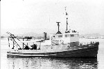
 Jean A |
| Survey Equipment | Survey Info | Data Type(s) | Data Collected |
|---|---|---|---|
| Echosounder | --- | Single Beam | |
| Current | --- | Mooring (physical oceanography) | |
| Raytheon radar | --- | Navigation |