Other ID: CI 7-78-2
Status: Completed
Organization(s): USGS, Woods Hole Coastal and Marine Science Center
Funding Program(s):
Principal Investigator(s): John M. Aaron
Affiliate Investigator(s):
Information Specialist(s):
Data Type(s): Location-Elevation: Navigation, Seismics: Sparker, Seismics: Sub Bottom Profiler
Scientific Purpose/Goals: Determine location and frequency of mass sediment movement and other geological hazards on the North Atlantic Continental Slope (Georges Bank area) using high-resolution geophysical methods.
Vehicle(s):
Start Port/Location: Woods Hole, MA
End Port/Location: Woods Hole, MA
Start Date: 1978-09-08
End Date: 1978-09-27
Equipment Used: Teledyne single-channel 300-500J 40-tip minisparker, ORE 140 transceiver/1036 transducer sub-bottom profiler, Northstar 6000 LORAN-C, Single channel hydrophone
Information to be Derived: Sea floor map; Morphology;
Summary of Activity and Data Gathered: Overall data quality is excellent, with good resolution and penetration. Some areas of rough topography obscured the underlying structure. Records show slumping and other mass sediment movement occurred at several places on the continental slope adjacent to Georges Bank. Slumping occurs in scales that range from small to large and in styles that range from simple downslope creep to major dislocation. Most slump bodies are found near the base of slope with marked erosional truncations above. Records from the edge of the continental shelf show numerous buried channels of varying size and configuration. Inside the 60 m isobath extensive fields of large sand waves are present. 3.5 kHz: 218 km; Minisparker: 2669 km; Airgun: 2142 km.
Staff: John M. Aaron, Thomas Aldrich, Sandra Conley, Alan Goodman, John C., Jr. Hampson, Kathleen Kent, Richard E. Sylwester
Affiliate Staff:
Charles J. McCreery
James Sullivan; Cecelia Gary - USGS-Reston
Dale Mihalyi - USGS-Corpus Christi
Notes: Original Center People field contained: John Aaron, Ch. Sci.; Richard Sylwester, Alan Goodman, Thomas C. Aldrich, Charles J. McCreery, John Hampson, Sandra Conley, Kathleen Kent, James Sullivan.
Project = North Atlantic OCS Environmental Assessment, North Atlantic OCS Environmental Assessment
Location:
North Atlantic outer continental shelf and slope, Georges Bank, United States, North America, North Atlantic;
| Boundaries | |||
|---|---|---|---|
| North: 41.12304474 | South: 39.47153833 | West: -70.50536511 | East: -66.21707069 |
Platform(s):
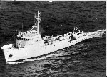 Columbus Iselin |
Bailey, N.G., and Aaron, J.M., 1982, High-resolution seismic-reflection profiles from the R/V Columbus Iselin, cruise CI 7-78-2, over the continental shelf and slope in the Georges Bank area: U.S. Geological Survey Open-File Report 1982-607, 2 p., https://doi.org/10.3133/ofr82607.
Chaytor, J.D., Twichell, D.C., and ten Brink, U. S., 2012, A reevaluation of the Munson-Nygren-Retriever Submarine Landslide Complex, Georges Bank Lower Slope, Western North Atlantic: In: Y. Yamada et al (Ed.), Submarine Mass Movements and their Consequences Book. Springer, doi: 10.1007/978-94-007-2162-3_12,.
Chaytor, J.D., ten Brink, Uri S., Solow, Andrew R., and Andrews, Brian D., 2009, Size distribution of submarine landslides along the U.S. Atlantic margin: Marine Geology, v. 264 no. 1-2, doi: 10.1016/j.margeo.2008.08.007.
Geist, E.L., Lynett, Patrick J., and Chaytor, Jason D., 2009, Hydrodynamic modeling of tsunamis from the Currituck landslide: Marine Geology, v. 264 no. 1-2, doi: 10.1016/j.margeo.2008.09.005.
ten Brink, U.S., Barkan, R., Andrews, B.D., and Chaytor, J.D., 2009, Size distributions and failure initiation of submarine and subaerial landslides: Earth and Planetary Science Letters, v. 287 no. 1-2, doi: 10.1016/j.epsl.2009.07.031.
Twichell, D.C., Chaytor, Jason D., ten Brink, Uri S., and Buczkowski, Brian, 2009, Morphology of late Quaternary submarine landslides along the U.S. Atlantic continental margin: Marine Geology, v. 264 no. 1-2, doi: 10.1016/j.margeo.2009.01.009.
| Title | Survey Equipment | Description |
|---|---|---|
| Cruise report | (document not focused on specific equipment) | Chief Scientist's cruise report including daily log, data collection, equipment notes, and track chart - scan of paper report (PDF). |
| Cruise report | (document not focused on specific equipment) | Chief Scientist's cruise report including daily log, data collection, equipment notes, and track chart - .txt file |
| Survey Equipment | Survey Info | Data Type(s) | Data Collected |
|---|---|---|---|
| Teledyne single-channel 300-500J 40-tip minisparker | --- | Sparker | |
| ORE 140 transceiver/1036 transducer sub-bottom profiler | --- | Sub Bottom Profiler | |
| Northstar 6000 LORAN-C | --- | Navigation | 1978-026-FA-LN-001 (Navigation trackline plot for field activity 78026) 1978-026-FA-LN-001-01 (Cruise track chart.) 1978-026-FA-LN-002 (Digital tapes of NV and NV-NSTAR-FINAL data: inv. # 1757 thru 1760, 1762 thru 1780, and 2809.) |
| Single channel hydrophone | --- | Air Gun / Water Gun Boomer Bubble Gun Sparker Sub Bottom Profiler | 1978-026-FA-SE-003 (analog tape of seismic data) 1978-026-FA-SE-001 ( Collection of paper record displays of seismic data( MSP) for lines ) 1978-026-FA-SE-002 (microfilm of ) 1978-026-FA-SE-001-01 (Electronic scans of some paper seismic profiles.) |
