Other ID: AII 103
Status: Completed
Organization(s): USGS, Woods Hole Coastal and Marine Science Center
Funding Program(s):
Principal Investigator(s): Bradford Butman
Affiliate Investigator(s):
Information Specialist(s):
Data Type(s): Environmental Data: CTD, Environmental Data: Temperature, Imagery: Photo, Location-Elevation: Navigation, Sampling: Biology, Sampling: Geology, Sonar: Single Beam, Time Series: Mooring (physical oceanography), Sonar: Sidescan
Scientific Purpose/Goals: 1. Deploy 5 tripod systems, 6 current moorings; recover 2 tripods and 2 current moorings. Monitor near-bottom circulation along the southern flank of Georges Bank through Great South Channel, and investigate coherence of flow between Georges Bank and the mid-Atlantic shelf. Study currents and sediment movement in the region of fine-grained sediments south of Martha's Vineyard. 2. Conduct temperature, salinity and suspended matter observations along shelf sections to determine position of moorings relative to coastal water masses to aid data interpretation. 3. Conduct sidescan sonar surveys to determine large-scale bedform distribution and direction of movement. 4. Recover, relight and replace necessary surface marker floats at tripod and current locations (so fishermen can avoid fouling their nets and leave instrumentation undisturbed).
Vehicle(s):
Start Port/Location: Woods Hole, MA
End Port/Location: Woods Hole, MA
Start Date: 1978-09-28
End Date: 1978-10-05
Equipment Used: XBT, CTD 19+ with OBS, PAR, DO, Chl, Grab sampler, Sidescan sonar, Northstar 6000 LORAN-C, 12 kHz, Camera- deep sea, Bottom platform
Information to be Derived: Time series data;
Summary of Activity and Data Gathered: Recovered tripods: 2 (#148 and 149 deployed FA 78010 OCEANUS 45 May 10-18, 1978); Recovered current moorings: 2 (#150, 151 deployed FA 78010 OCEANUS 45 May 10-18, 1978). Deployed tripods: 5 (#155 and 156 both recovered FA 79002 OCEANUS 56 Mar. 6-15, 1979; #157 recovered FA 78035 WHITEFOOT Oct. 30 - Nov. 2, 1978; #158 and 159 both recovered FA 79002 OCEANUS 56 Mar. 6-15, 1979); Deployed current moorings: 6 (#160 recovered FA 79002 OCEANUS 56 Mar. 6-15, 1979; #161 incomplete recovery information; #162 partial recovery by fisherman OCEAN STATE Oct. 16, 1978; #163 recovered FA 79002 OCEANUS 56 Mar. 6-15, 1979; #164 recovered Jan. 30, 1979 no ship and cruise information; #165 recovered FA 79002 OCEANUS 56 Mar. 6-15, 1979). XBTs: 61; CTD/Transmissions: 33; Surface salinity: 91; Surface grab samples: 7 (#4727-4733); Sidescan sonar: 18 km.
Staff: Cynthia Bryden, Bradford Butman, Charles E. Deadmon, Carol M. Parmenter, Stephanie Pfirman, William J. Strahle, David Twichell, Marlene Noble
Affiliate Staff:
Neal Lillard - USGS-Corpus Christi; John West - USGS-Corpus Christi; B. Reckert - USGS-Washington; J. Ratcliff - Benthos; Andrew Eliason - Eliason Data Services; T. Sackton - Observer
Mass. Fair Share; T. Dourdeville - WHOI
Notes: Information from Foghorn: XBT;CTD;Surface grab sampler;Sidescan sonar system;
Location:
Middle Atlantic Bight, Mid-Atlantic Shelf, Wilmington Canyon, Mud Patch, Great South Channel, Georges Bank, United States, North America, North Atlantic;
| Boundaries | |||
|---|---|---|---|
| North: 41.75 | South: 38.25 | West: -74.25 | East: -66 |
Platform(s):
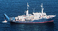 Atlantis II |
Moody, J.A., and Butman, B., 1980, Semidiurnal bottom pressure and tidal currents on Georges Bank and in the Mid-Atlantic Bight: U.S. Geological Survey Open-File Report 80-1137, https://doi.org/10.3133/ofr801137.
Moody, J.A., Butman, B., Beardsley, R.C., Brown, W.S., Daifuku, P., Irish, J.D., Mayer, D.A., Mofjeld, H.O., Petrie, B., Ramp, S., Smith, P., and Wright, W.R., 1984, Atlas of tidal elevation and current observations on the Northeast American continental shelf and slope: U.S. Geological Survey Bulletin 1611, https://doi.org/10.3133/b1611.
Parmenter, C.M., Bother, M. H., Butman, B., 1983, Characteristics of resuspended sediment from Georges Bank collected with a sediment trap: Estuarine, Coastal and Shelf Science, v. 17, no. 5, p. 521-533.
| Title | Survey Equipment | Description |
|---|---|---|
| Cruise report | (document not focused on specific equipment) | Chief Scientist's cruise report of personnel, equipment, data acquisition, station locations, track maps, bridge Loran log, and smooth sheets. |
| Survey Equipment | Survey Info | Data Type(s) | Data Collected |
|---|---|---|---|
| XBT | --- | Temperature | |
| CTD 19+ with OBS, PAR, DO, Chl | --- | CTD | |
| Grab sampler | --- | Biology Geology | 1978-031-FA-SC-001 (GRAB samples) |
| Sidescan sonar | --- | Sidescan | 1978-031-FA-SO-001 (microfilm of *SMALL CAN) |
| Northstar 6000 LORAN-C | --- | Navigation | 1978-031-FA-LN-001 (Navigation trackline plot for field activity 78031) |
| 12 kHz | --- | Single Beam | 1978-031-FA-SE-001 ( Collection of paper record displays of seismic data (12K) for lines ) |
| Camera- deep sea | --- | Photo | 1978-031-FA-PH-001 (film collection of TRIPOD 159; 19781003-19790309) |
| Bottom platform | --- | Mooring (physical oceanography) | 1978-031-FA-OM-003 (MAB mooring data, ) 1978-031-FA-OM-002 (Georges Bank Sediment mooring data) 1978-031-FA-OM-001 (Digital tape(s) of CTD STATION DATA, ) |
