Other ID: GS 7903-2, Leg 2
Status: Completed
Organization(s): USGS, Woods Hole Coastal and Marine Science Center
Funding Program(s):
Principal Investigator(s): Robert N. Oldale
Affiliate Investigator(s):
Information Specialist(s): Diane M. Eskenasy
Data Type(s): Electro-Magnetic: Gravity, Electro-Magnetic: Magnetics, Location-Elevation: Navigation, Seismics: Air Gun / Water Gun, Seismics: Boomer, Seismics: Sub Bottom Profiler
Scientific Purpose/Goals: Investigate the structure and origin of Stellwagen Bank and Stellwagen Basin, locate the offshore extensions of the Clinton-Newbury and Bloody Bluff faults, and connect known Cretaceous and Jurassic seismic stratigraphy south of the New England seamounts with that north of the seamounts.
Vehicle(s):
Start Port/Location: Woods Hole, MA
End Port/Location: Provincetown, MA
Start Date: 1979-06-01
End Date: 1979-06-07
Equipment Used: Air gun, Boomer, 3.5 kHz, Marine magnetometer, Gravity meter (wh), Integrated Navigation System, Single channel hydrophone
Information to be Derived: Morphology;
Summary of Activity and Data Gathered: Continuous profiling with airgun, Uniboom, 3.5 kHz, gravimeter, and magnetometer: 1260 km.
Staff: Robert F. Bowles, James E. Dodd, David Egelson, Diane M. Eskenasy, Alan Goodman, Barry Irwin, Kim D. Klitgord, John Larson, David Mason, Charles J. O'Hara, Robert N. Oldale, Valerie Paskevich
Affiliate Staff:
Wallace Bothner - UNH/USGS-Denver; Matthew Oldale - Guest Scientist
Ball State University; Gretchen Rich - Guest Scientist
UNH; Robert Simpson - USGS-Denver
Notes: Original Center People field contained: Bob Oldale - Ch. Sci., Robert Bowles - Nav., James Dodd - Nav., David Egelson, Diane Eskenasy - Cruise Curator, Alan Goodman - Tech., Barry Irwin - Tech., Kim Klitgord, John Larson - Tech., David Mason - Tech., Charles O'Hara, Valerie Paskevich - Nav.
Location:
western Gulf of Maine, Maine, New Hampshire, Massachusetts Bay, Massachusetts, United States, North America, North Atlantic;
| Boundaries | |||
|---|---|---|---|
| North: 43.40903795 | South: 42.05 | West: -70.87456281 | East: -69.45 |
Platform(s):
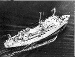 James M Gilliss |
Oldale, Robert N., and Bick, Jennifer, 1987, Maps and seismic profiles showing geology of the inner continental shelf, Massachusetts Bay, Massachusetts: U.S. Geological Survey Miscellaneous Field Studies Map MF-1923, 4 sheets, https://doi.org/10.3133/mf1923.
Oldale, R.N., and Edwards, G.B., 1991, Cores from marine geologic features in the western Gulf of Maine: U.S. Geological Survey Miscellaneous Field Studies Map MF-2147, 2 sheets, URL: https://doi.org/10.3133/mf2147.
Oldale, R.N., and Wommack, L.E., 1987, Maps and seismic profiles showing geology of the inner continental shelf, Cape Ann, Massachusetts to New Hampshire: U.S. Geological Survey Miscellaneous Field Studies Map MF-1892, 2 sheets, scale 1:125,000, URL: https://doi.org/10.3133/mf1892.
| Title | Survey Equipment | Description |
|---|---|---|
| Cruise report | (document not focused on specific equipment) | Cruise Data Curator's report describing purpose, personnel, equipment and data acquisition notes, and trackmap. |
| Cruise log | (document not focused on specific equipment) | Watchstanders' log containing time and position data, acquisition equipment, configuration and settings, start and end of Uniboom, airgun, and 3.5 kHz, magnetometer and gravity lines, seismic recorder, magnetometer and compressor maintenance. |
| Navigation log | Integrated Navigation System | Northstar and Integrated Navigation System log containing day and time, ship speed, latitude and longitude, start and end of lines, equipment performance, satellite update quality. |
| Survey Equipment | Survey Info | Data Type(s) | Data Collected |
|---|---|---|---|
| Air gun | --- | Air Gun / Water Gun | |
| Boomer | --- | Boomer | |
| 3.5 kHz | --- | Sub Bottom Profiler | |
| Marine magnetometer | --- | Magnetics | 1979-012-FA-GP-002-01 (Gravity and Magnetic data recovered from 9 track tape) 1979-012-FA-GP-001 (Digital tapes of GR-BELL, GR, MG, MG-RAW 20 SEC, MG-RAW 1 MIN, GR-L&R, and NV/GR/VN/VE/RWG data: inv. # 0983, 1090, 1429, 1978, 1998, 1999, 2000, 2001, 2315, 2327, 2479, 2631, and 3918.) |
| Gravity meter (wh) | --- | Gravity | 1979-012-FA-GP-001-01 (Gravity and Magnetic data recovered from 9 track tape) 1979-012-FA-GP-002 (Digital tapes of GR-BELL, GR, MG, MG-RAW 20 SEC, MG-RAW 1 MIN, GR-L&R, and NV/GR/VN/VE/RWG data: inv. # 0983, 1090, 1429, 1978, 1998, 1999, 2000, 2001, 2315, 2327, 2479, 2631, and 3918.) |
| Integrated Navigation System | --- | Navigation | 1979-012-FA-LN-001-01 (Drafted track map depicting seismic lines including Uniboom for FA 79012 (GILLIS 7903-2) and Uniboom seismic track lines for FA 80010 (ASTERIAS 80-6A).) 1979-012-FA-LN-002-01 (Nav. Tape 1941 (txt) Final FIXE navigation.) 1979-012-FA-LN-002-02 (Navigation data) 1979-012-FA-LN-001 (Navigation trackline plot for field activity 79012) 1979-012-FA-LN-002 (Digital tapes of NV, NV-INS, NV-FINAL, NV 5 MIN, NV 20 SEC, NV 1 MIN, NV/GR/VN/VE/RWG, and NV-INS-FINAL data: 1907, 1908, 1909, 1910, 1911, 1912, 1913, 1914, 1915, 1939, 1940, 1941, 1945, 1959, 1978, 2000, 2001, 2046, 2631, 2778, 2779, 2780, 2781, and 2782.) |
| Single channel hydrophone | --- | Air Gun / Water Gun Boomer Bubble Gun Sparker Sub Bottom Profiler | 1979-012-FA-SE-002 (microfilm of W/NAV) 1979-012-FA-SE-003 (analog tape of seismic data) 1979-012-FA-SE-001 ( Collection of paper record displays of seismic data( 3.5K) for lines ) |
