Other ID: B 3 - hi/fo, Tbg.-Nr. 10.549/95
Status: Completed
Organization(s): USGS, Woods Hole Coastal and Marine Science Center
Funding Program(s):
Principal Investigator(s): Deborah Hutchinson
Affiliate Investigator(s): Dr. Karl Hinz, BGR contact
Information Specialist(s):
Data Type(s): Electro-Magnetic: Gravity, Electro-Magnetic: Magnetics, Location-Elevation: Navigation, Seismics: Multichannel, Seismics: Sonobuoy
Scientific Purpose/Goals: Collect CDP seismic lines along the east coast of the United States north of Cape Hatteras.
Vehicle(s):
Start Port/Location:
End Port/Location:
Start Date: 1979-08-12
End Date: 1979-09-02
Equipment Used: Multichannel seismics, Magnetometer (wh), Gravity meter (wh), Integrated Navigation System
Information to be Derived:
Summary of Activity and Data Gathered: Collected CDP Lines BGR-79-201 (BGR201) through BGR-79-221 (BGR221); Gravity data; Magnetics data; Navigation.
Staff: John S. Schlee
Affiliate Staff:
Bundesanstalt fur Geowissenschaften und Rohstoffe (BGR - German Federal Institute for Geosciences and Natural Resources): Weekmann
Range
Schmidt
de Camp
Notes: Submitted 07/27/09 by A. Orton for Debbie Hutchinson.
Location:
Georges Bank to Virginia, U.S. Atlantic slope, shelf and rise, United States, North America, North Atlantic;
| Boundaries | |||
|---|---|---|---|
| North: 42 | South: 36 | West: -75 | East: -65 |
Platform(s):
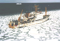
 Explora |
Flores, C.H., Brothers, D.S., ten Brink, U.S., and Chaytor, J.D, 2011, New geophysical constraints on the stratigraphy and structure of the southern New England continental margin [abs.]: , 2011 Fall AGU Meeting. San Francisco, CA, December 5-9, 2011.
Klitgord, K.D., Poag, C.W., Schneider, C.M., and North, L., 1994, Geophysical database of the East Coast of the United States northern Atlantic margin—Cross sections and gridded database (Georges Bank Basin, Long Island Platform, and Baltimore Canyon Trough): U.S. Geological Survey Open-File Report 94-637, https://doi.org/10.3133/ofr94637.
Klitgord, K.D., and Schneider, C.M., Geophysical database of the east coast of the United States northern Atlantic margin—Velocity analyses: U.S. Geological Survey Open-File Report 94-192, https://doi.org/10.3133/ofr94192.
| Survey Equipment | Survey Info | Data Type(s) | Data Collected |
|---|---|---|---|
| Multichannel seismics | --- | Multichannel | 1979-023-FA-SE-001 (Digital tape(s) of NV,GR,WD,MG,TIME, NV-SSP, NV-BGR SEISMICS, ) 1979-023-FA-SE-002-01 (Paper record section of Lines 79-201, 79-202, 79-203, 79-204, 79-205, 79-206, 79-207, 79-208, 79-209, 79-210, 79-211, 79-212, 79-213, 79-214, 79-215, 79-216, 79-217, 79-218, 79-219, 79-220, 79-221, ) |
| Magnetometer (wh) | --- | Magnetics | 1979-023-FA-GP-002 (Digital tape(s) of NV,GR,WD,MG,TIME, NV-SSP, NV-BGR SEISMICS, ) |
| Gravity meter (wh) | --- | Gravity | 1979-023-FA-GP-001 (Digital tape(s) of NV,GR,WD,MG,TIME, NV-SSP, NV-BGR SEISMICS, ) |
| Integrated Navigation System | --- | Navigation | 1979-023-FA-LN-001 (CDP navigation trackline plots for field activity 79023) 1979-023-FA-LN-002-01 (Navigation data) 1979-023-FA-LN-002 (Digital tape(s) of NV,GR,WD,MG,TIME, NV-SSP, NV-BGR SEISMICS, ) |