Other ID: 79-6
Status: Completed
Organization(s): USGS, Woods Hole Coastal and Marine Science Center
Funding Program(s):
Principal Investigator(s): Kurt Grove
Affiliate Investigator(s):
Information Specialist(s):
Data Type(s): Environmental Data: Current, Time Series: Mooring (physical oceanography), Location-Elevation: Navigation
Scientific Purpose/Goals: Measure currents over Escollo de Arenas, a large sand body northwest of Vieques, Puerto Rico.
Vehicle(s):
Start Port/Location:
End Port/Location:
Start Date: 1979-08-20
End Date: 1979-08-24
Equipment Used: Current drogues, Current, Plane table-transit-radios triangulation
Information to be Derived: Time series data;
Summary of Activity and Data Gathered: Owing to last minute changes in the scientific party, the cruise went off with a bare minimum of personnel. The crew of the R/V JEAN A, however, freely offered their assistance and the offer was gratefully accepted. Their help greatly increased the amount of data we were able to collect in the short time we were out. Tides over the escollo are semidiurnal. Current drogue studies conducted during daylight hours monitored water velocities between low flood and low ebb maximums for 3 consecutive days (8/21 - 8/23). On the 23rd, the JEAN A anchored over the middle of the escollo and monitored currents at a stationary site using a hand-held current meter with deck readout. Current drogue data: 3 days; Hand-held current meter data: 1 day.
Staff: Rafael W. Rodriguez, Kurt Grove
Affiliate Staff:
Jose Muniz - Puerto Rico Geological Survey; Abraham Machado - Puerto Rico Dept. Nat. Resources
Notes: Original Center People field contained: Kurt Grove - Ch. Sci.; Rafael Rodriguez (Aug. 20-21).
Project = Puerto Rico Marine Geology Co-op, Puerto Rico Marine Geology Co-op
Location:
Escollo de Arenas, Isla de Vieques, Puerto Rico, Caribbean Sea, United States, North America, North Atlantic;
| Boundaries | |||
|---|---|---|---|
| North: 18.4 | South: 18.35 | West: -65.7 | East: -65.6 |
Platform(s):
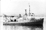
 Jean A |
| Survey Equipment | Survey Info | Data Type(s) | Data Collected |
|---|---|---|---|
| Current drogues | --- | Current | |
| Current | --- | Mooring (physical oceanography) | |
| Plane table-transit-radios triangulation | --- | Navigation |