Other ID: 88
Status: Completed
Organization(s): USGS, Woods Hole Coastal and Marine Science Center
Funding Program(s):
Principal Investigator(s): Bradford Butman
Affiliate Investigator(s):
Information Specialist(s):
Data Type(s): Environmental Data: CTD, Environmental Data: Temperature, Imagery: Photo, Location-Elevation: Navigation, Sampling: Biology, Sampling: Chemistry, Sampling: Geology, Sonar: Single Beam, Time Series: Mooring (physical oceanography)
Scientific Purpose/Goals: Recover 3 tripod moorings, 3 current moorings, and 7 surface buoys on the shelf; deploy 3 tripods and 4 current moorings in and around Lydonia Canyon; conduct hydrographic measurements (XBT, CTD, and suspended sediment sampling) along shelf transects and in Lydonia Canyon; obtain surface grabs at tripod stations at the head of Lydonia Canyon; and obtain seasonal benthic samples at Stations A, K and Q.
Vehicle(s):
Start Port/Location: Woods Hole, MA
End Port/Location: Woods Hole, MA
Start Date: 1980-10-23
End Date: 1980-10-31
Equipment Used: Echosounder, XBT, CTD 19+ with OBS, PAR, DO, Chl, Niskin bottle, Van Veen grab sampler, Smith-MacIntyre grab, Camera- deep sea, Northstar 6000 LORAN-C, 12 kHz, Bottom platform
Information to be Derived:
Summary of Activity and Data Gathered: All moorings were deployed as planned with the exception of the tripod at Station L. The instrument malfunctioned on deck and will be deployed on the November OCEANUS cruise. Because of the two days of bad weather and the return to Woods Hole for medical attention, there was no time for hydrography on Georges Bank. All moorings were recovered as planned except for a lost surface mooring at Station MAB and the tripod system at GBK. The surface buoys at GBK were left until the tripod is recovered. Moorings deployed: 8 (#203, 204, 209, 210, 212, 213, and 218 recovered FA 81009 OCEANUS 95 Apr. 3 - May 6, 1981; #206 recovered FA 81002 OCEANUS 91 Jan. 16-22, 1981). Moorings recovered: 5 (#193, 194, 196 partial, 197, and 198 deployed FA 80009 OCEANUS 81 May 23 - Jun. 1, 1980). Surface buoys deployed: 6 (K, M, Q, U, V, R); Surface buoys recovered: 3 (A, S, T); Lost: 1 VACM (from #198). CTD stations: 3; XBT stations: 16; Surface salinity: 15; Grab samples: 1.
Staff: Michael Bothner, Bradford Butman, John Larson, Carol M. Parmenter, Richard Rendigs, William J. Strahle, Marlene Noble
Affiliate Staff:
Scott Chalker
Frank Musialowski; WHOI: Nancy Copley
William MacLeish
Rose Petrecca
Notes: Tripod at L malfunctioned; will be deployed Nov. 1980 OCEANUS cruise. Tripod at GBK line parted; will be recovered on Nov. 1980 OCEANUS cruise. Original Center People field contained: Brad Butman, Chief Scientist; Mike Bothner, Scott Chalker, John Larson, Frank Musialowski, Marlene Noble, Carol Parmenter, Richard Rendigs, William Strahle.
Project = Lydonia Canyon Sediment Dynamics, Lydonia Canyon Sediment Dynamics
Location:
Mid-Atlantic Continental Shelf, Wilmington Canyon, Georges Bank, Lydonia Canyon, New Jersey Shelf, United States, North America, North Atlantic;
| Boundaries | |||
|---|---|---|---|
| North: 41.09028 | South: 38.49028 | West: -73.8044 | East: -67.20028 |
Platform(s):
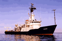
 Oceanus |
Butman, B., 1988, North Atlantic Slope and Canyon Study—Volume 1, Executive summary: U.S. Geological Survey Open-File Report 88-027-A, https://doi.org/10.3133/ofr8827A.
Butman, B., and Conley, S.J., 1984, Lydonia Canyon experiment—data report for moored array deployment I, October 1980-April 1981: U.S. Geological Survey Open-File Report 84-201, https://doi.org/10.3133/ofr84201.
Butman, B., and Moody, J.A., 1984, Bathymetric map of Lydonia Canyon, U.S. Atlantic Outer Continental Shelf: U.S. Geological Survey Miscellaneous Field Studies Map 1710, https://doi.org/10.3133/mf1710.
Noble, M.A., 1988, The regional structure of subtidal currents within and around Lydonia Canyon, Chapter 5, in Butman, B., ed., North Atlantic Slope and Canyon Study; Volume 2: U.S. Geological Survey Open-File Report (88-27B), https://doi.org/10.3133/ofr8827B.
| Title | Survey Equipment | Description |
|---|---|---|
| Cruise report | (document not focused on specific equipment) | Chief Scientist's cruise report including personnel, equipment, daily narrative, mooring locations, station list indicating data acquired at the station, trackmap and mooring location map. |
| Survey Equipment | Survey Info | Data Type(s) | Data Collected |
|---|---|---|---|
| Echosounder | --- | Single Beam | |
| XBT | --- | Temperature | |
| CTD 19+ with OBS, PAR, DO, Chl | --- | CTD | 1980-030-FA-OM-001 (Digital tape of CTD STATION DATA: inv. # 2436.) |
| Niskin bottle | --- | Chemistry | |
| Van Veen grab sampler | --- | Geology | |
| Smith-MacIntyre grab | --- | Biology Geology | |
| Camera- deep sea | --- | Photo | 1980-030-FA-PH-001 (film collection of TRIPOD 204; 19801024-19810424) |
| Northstar 6000 LORAN-C | --- | Navigation | 1980-030-FA-LN-001 (Digital tapes of NV and NV-NSTAR data: inv. # 2204 thru 2207, and 2788.) |
| 12 kHz | --- | Single Beam | 1980-030-FA-SE-001 ( Collection of paper record displays of seismic data( 12K) for lines ) |
| Bottom platform | --- | Mooring (physical oceanography) | 1980-030-FA-OM-003 (Lydonia Canyon mooring data) 1980-030-FA-OM-002 (Georges Bank Sediment mooring data) |