Other ID: 81-1
Status: Completed
Organization(s): USGS, Woods Hole Coastal and Marine Science Center
Funding Program(s):
Principal Investigator(s): Frank T. Manheim
Affiliate Investigator(s):
Information Specialist(s):
Data Type(s): Seismics: Sub Bottom Profiler, Biological Field Study: Experiments (biological), Location-Elevation: Navigation, Sampling: Geology
Scientific Purpose/Goals: Test short-barrel piston corer to recover hard substrate and sample for phosphorites on the west Florida shelf.
Vehicle(s):
Start Port/Location: St. Petersburg, FL
End Port/Location: Key West, FL
Start Date: 1981-05-22
End Date: 1981-05-25
Equipment Used: ORE 140 transceiver/1036 transducer sub-bottom profiler, Northstar 6000 LORAN-C, Piston corer
Information to be Derived:
Summary of Activity and Data Gathered: Cores: 17; 3.5 kHz data: 307 km; LORAN-C data: 359 km.
Staff: Richard Rendigs, Frank T. Manheim, Raymond E. Hall, Candy Bostwick, Paul Bowker, John West
Affiliate Staff:
David Brewster - GFA
Dave Queeley - MPES; Beecher Wooding - WHOI
Ch. Tech.
Notes: Original Center People field contained: Frank Manheim - Ch. Sci.; Paul Bowker - PST, Richard Rendigs - geologist, Ray Hall - paleontologist, David Brewster - GFA, Candy Lane - GFA, Dave Queeley - MPES, John West - ET.
Information from Foghorn: ORE fish and transceiver for 3.5 kHz acoustic profiling;EPC 4100 recorder, 1700 lb. weight stand w/ 10 ft. 3 in. pipe for piston coring;hydraulic core extruder;binocular microscope;chemical equipment for phosphate testing;
Location:
southwest Florida shelf, Florida, Gulf of Mexico, United States, North America, North Atlantic;
| Boundaries | |||
|---|---|---|---|
| North: 27.6 | South: 25.75 | West: -83.2 | East: -81.9 |
Platform(s):
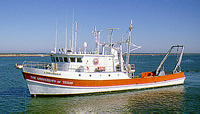 Longhorn |
| Title | Survey Equipment | Description |
|---|---|---|
| Cruise report | (document not focused on specific equipment) | Brief chief scientist's cruise report including personnel list and equipment. Also includes a table of station information and a trackmap. |
| Survey Equipment | Survey Info | Data Type(s) | Data Collected |
|---|---|---|---|
| ORE 140 transceiver/1036 transducer sub-bottom profiler | --- | Sub Bottom Profiler | |
| Northstar 6000 LORAN-C | --- | Navigation | |
| Piston corer | --- | Geology | 1981-013-FA-NL-001-02 (Core collection log with location, water depth, equipment description, and core and subsample description.
) |
