Other ID: 82FARN-7; FARN 82-7
Status: Completed
Organization(s): USGS, Woods Hole Coastal and Marine Science Center
Funding Program(s):
Principal Investigator(s): Louis E. Garrison
Affiliate Investigator(s): Neil Kenyon - IOS
Information Specialist(s):
Data Type(s): Environmental Data: Temperature, Location-Elevation: Navigation, Seismics: Air Gun / Water Gun, Sonar: Sidescan, Sonar: Single Beam
Scientific Purpose/Goals: Survey the continental slope in the northern Gulf of Mexico with the GLORIA long-range sidescan-sonar, a cooperative study with the Institute of Oceanographic Sciences, Godalming, England.
Vehicle(s):
Start Port/Location: New Orleans, LA
End Port/Location: Miami, FL
Start Date: 1982-02-02
End Date: 1982-02-24
Equipment Used: GLORIA sidescan, Air gun, 10 kHz Bathymetry, XBT, Northstar 6000 LORAN-C, Magnavox satellite positioning system, Single channel hydrophone
Information to be Derived: Sea floor map; Bathymetric maps;
Summary of Activity and Data Gathered: The cruise collected 3,731 nautical miles of data on the continental slope in 17 days for the USGS, and in 2 additional days collected 395 nautical miles (732 km) of sidescan, 10 kHz echo sounder and large airgun data for an IPOD site survey on Mississippi Fan. The IPOD data will be deposited in the IPOD data bank when processing is completed. GLORIA sidescan sonar: 6910 km (12 reels of 9-track digital magnetic tapes, 12 reels of analog magnetic tapes, 464 photo negatives, photo prints, speed rectified sidescan data, shipboard monitor records); 10 kHz echo sounder: 6910 km (2 sec. sweep shipboard records, 0.5 sec. sweep shipboard records); Airgun: 6910 km (59 reels of analog magnetic tape, shipboard monitor records); Navigation: 50 Northstar cassette recordings from bridge, 19 magnetic tapes from seismic lab, 8 rolls printout from bridge, 4 rolls printout from seis lab, 1 reel digital 9-track tape of LORAN-C plus satellite fixes with water depths; XBT records: 69.
Staff: Mahlon M. Ball, Dann Blackwood, Kathryn Scanlon Catanach, Edward Escowitz, Louis E. Garrison, Richard E. Sylwester, David Twichell, John West
Affiliate Staff:
Sarah Eisner - nav. watch/photo tech.; Steve Wolf - nav. watch; IOS: Neil Kenyon - co-Ch. Sci.
Robin Bonner - airgun
John Campbell - GLORIA tech.
Gareth Knight - computer op.
Adrian Lewis - computer op.
Michael Somers - Ch. GLORIA engineer
Notes: Original Center People field contained: Louis Garrison - co-Ch. Sci., USGS-Corpus Christi; Mahlon Ball - nav. watch, USGS-Miami; Dann Blackwood - photo tech., USGS-Woods Hole; Sarah Eisner - nav. watch/photo tech.; Edward Escowitz - nav. watch/XBTs, USGS-Reston; Kathy Scanlon - nav. watch/bathymetry, USGS-Woods Hole; Richard Sylwester - elec. tech./data mgr., USGS-Woods Hole; Dave Twichell - GLORIA watch, USGS-Woods Hole; John West - elec. tech./airgun, USGS-Corpus; Steve Wolf - nav. watch.
Project = GLORIA, GLORIA
Location:
continental slope, northern Gulf of Mexico, United States, North America, North Atlantic;
| Boundaries | |||
|---|---|---|---|
| North: 29.5 | South: 26.25 | West: -96 | East: -88 |
Platform(s):
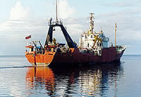
 Farnella |
Paskevich, V.F., 2000, Gulf of Mexico GLORIA sidescan sonar geologic interpretation—ArcView data coverages: U.S. Geological Survey Open-File Report 2000-019, https://doi.org/10.3133/ofr0019.
Twichell, D.C. Cross, V.A., Paskevich, V.F., Hutchinson, D.R., Winters, W.J., and Hart, P.E., 2006, GIS of selected geophysical and core data in the northern Gulf of Mexico continental slope collected by the U.S. Geological Survey: U.S. Geological Survey Open-File Report 2005-1071, DVD-ROM, also available from https://doi.org/10.3133/ofr20051071.
Twichell, D.C., McGregor, B.A., and Lubinski, D.J., 1989, Seismic-reflection data from R/V FARNELLA cruises FRNL82-7, FRNL85-1, FRNL85-2, and FRNL85-3A in the U.S. Gulf of Mexico EEZ: U.S. Geological Survey Open-File Report 89-549, 7 p., URL: https://doi.org/10.3133/ofr89549.
Twichell, D.C., and Paskevich, V.F., 1996, GLORIA sidescan-sonar field data and navigation data collected in the Gulf of Mexico during R/V FARNELLA cruises in 1982 and 1985: U.S. Geological Survey Open-File Report 96-707, https://doi.org/10.3133/ofr96707.
| Title | Survey Equipment | Description |
|---|---|---|
| Cruise report | (document not focused on specific equipment) | Chief Scientist's cruise report including personnel, equipment, data acquired, and trackmap. Also includes the NOAA crusie inventory form. and geophysical data docoumentation form. |
| Data inventory | (document not focused on specific equipment) | Cruise Curator's scanned handwritten inventory of seismic lines, airgun, 10 kHz, GLORIA sidescan, and navigation lines in terms of line number and start and end, and paper roll number# or tape number (appropriate for the data type). |
| Survey Equipment | Survey Info | Data Type(s) | Data Collected |
|---|---|---|---|
| GLORIA sidescan | --- | Sidescan | 1982-005-FA-SO-002 (CD ROM disk of GLORIA/MOSAIC 1-16, GLORIA ATLANTIC GEOTIFF, GLORIA GULF MEXICO GEOTIFF, ) GLORIA Sidescan Sonar Imagery 1982-005-FA-SO-001 (Digital tape(s) of NV,BT, SSS-GLORIA DATA, NV-GLORIA DATA, NV-BT, LINES1,2A, LINES2A, LINES3A,4AB, LINES5CD,6EF,X1*, LINES5AB,6BA, LINES6BA,7, LINES8,9, LINES9,10, LINES11,12,X2, LINES2B,3B,6-8, LINESMF1-MF8, LINESMF9,MF10,FS1, ) |
| Air gun | --- | Air Gun / Water Gun | |
| 10 kHz Bathymetry | --- | Single Beam | 1982-005-FA-BA-001 (Digital tape(s) of NV,BT, SSS-GLORIA DATA, NV-GLORIA DATA, NV-BT, LINES1,2A, LINES2A, LINES3A,4AB, LINES5CD,6EF,X1*, LINES5AB,6BA, LINES6BA,7, LINES8,9, LINES9,10, LINES11,12,X2, LINES2B,3B,6-8, LINESMF1-MF8, LINESMF9,MF10,FS1, ) 1982-005-FA-SE-004 (Collection of paper record displays of seismic data(AIR) and 10 kHz Echo Sounder for various lines.) NGDC MGD77 data |
| XBT | --- | Temperature | |
| Northstar 6000 LORAN-C | --- | Navigation | 1982-005-FA-LN-001 (Digital tape(s) of NV,BT, SSS-GLORIA DATA, NV-GLORIA DATA, NV-BT, LINES1,2A, LINES2A, LINES3A,4AB, LINES5CD,6EF,X1*, LINES5AB,6BA, LINES6BA,7, LINES8,9, LINES9,10, LINES11,12,X2, LINES2B,3B,6-8, LINESMF1-MF8, LINESMF9,MF10,FS1, ) 1982-005-FA-LN-002 (Trackplot) Nav data |
| Magnavox satellite positioning system | --- | Navigation | |
| Single channel hydrophone | --- | Air Gun / Water Gun Boomer Bubble Gun Sparker Sub Bottom Profiler | 1982-005-FA-SE-002 (microfilm of ) 1982-005-FA-SE-003 (analog tape of seismic data) 1982-005-FA-SE-001 (Collection of paper record displays of seismic data(AIR) and 10 kHz Echo Sounder for various lines.) |