Other ID: NE-82-1
Status: Completed
Organization(s): USGS, Woods Hole Coastal and Marine Science Center
Funding Program(s):
Principal Investigator(s): Peter Popenoe, George B. Tirey
Affiliate Investigator(s):
Information Specialist(s):
Data Type(s): Seismics: Multichannel, Seismics: Sparker, Sonar: Single Beam, Location-Elevation: Navigation
Scientific Purpose/Goals: The cruise was conducted for the Reactor Hazards Research Program to gain knowledge on structural elements of the southeastern margin. The cruise was also aimed at gathering stratigraphic information in the Cape Hatteras area. A secondary objective of conducting shallow seismic and sidescan sonar surveys within Albemerle Sound as a sedimentation study was aborted when sparker data was found to interfere (cross talk) with the deeper airgun records.
Vehicle(s):
Start Port/Location: Elizabeth City Shipyard Marine, Elizabeth City, NC
End Port/Location: US Coast Guard Dock, Great Bridge, VA
Start Date: 1982-04-15
End Date: 1982-04-29
Equipment Used: Multichannel seismics, Innerspace Technology 25-joule sparker, Raytheon DE-719 precision echo sounder, Motorola Mini-Ranger III, Northstar 6000 LORAN-C
Information to be Derived:
Summary of Activity and Data Gathered: Surveying did not begin before April 19th due to equipment set-up and repair issues. I consider the cruise quite successful, due in large part to the efforts of the personnel who tirelessly gave their best efforts. 12-channel data: 208 km.
Staff: David Mason, Gregory Miller, David Nichols, Peter Popenoe, Frank W. Jennings, George B. Tirey, Jack Connell
Affiliate Staff:
Notes: Original Center People field contained: Peter Popenoe - Co-Ch. Sci.; Rusty Tirey - Co-Ch. Sci.; Dave Nichols - Chief Technician; Jack Connell - Boat Operator; Dave Mason - Onshore Support; Frank Jennings (5/15-5/18); Greg Miller (5/15-5/20).
Project = South Atlantic Enviromental, South Atlantic Enviromental
Location:
Albemarle Sound, North Carolina, United States, North America, North Atlantic;
| Boundaries | |||
|---|---|---|---|
| North: 36.5 | South: 35.5 | West: -77 | East: -75.75 |
Platform(s):
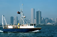
 Neecho |
Popenoe, P., and Ward, Lauck W., 1983, Description of high-resolution seismic reflection data collected in Albemarle and Croatan Sounds, North Carolina (cruise NE-82-1): U.S. Geological Survey Open-File Report 83-513, 3 p., URL: https://doi.org/10.3133/ofr83513.
| Title | Survey Equipment | Description |
|---|---|---|
| Cruise report | (document not focused on specific equipment) | Chief Scientist's cruise report of personnel, equipment, data acquisition notes,cruise narrative, and track chart. Includes a sketch of the streamer configuration. |
| Survey Equipment | Survey Info | Data Type(s) | Data Collected |
|---|---|---|---|
| Multichannel seismics | --- | Multichannel | 1982-009-FA-SE-001 ( Collection of paper record displays of seismic data( H2O) for lines ) 1982-009-FA-SE-002 (microfilm of ) |
| Innerspace Technology 25-joule sparker | --- | Sparker | |
| Raytheon DE-719 precision echo sounder | --- | Single Beam | |
| Motorola Mini-Ranger III | --- | Navigation | |
| Northstar 6000 LORAN-C | --- | Navigation | 1982-009-FA-LN-001 (Navigation trackline plot for field activity 82009) |