Other ID: 89-A and 89-B; 82-1
Status: Completed
Organization(s): USGS, Woods Hole Coastal and Marine Science Center
Funding Program(s):
Principal Investigator(s): Charles W. Holmes
Affiliate Investigator(s):
Information Specialist(s):
Data Type(s): Seismics: Boomer, Sampling: Geology, Sampling: Biology, Sampling: Chemistry, Location-Elevation: Navigation
Scientific Purpose/Goals: Leg A: Investigate the nature and extent of the quartz sand patch and phosphate enrichment along the western margin of the Florida peninsula. Leg B: Investigate the nature and development of the southern bank that extends west of the Key West region.
Vehicle(s):
Start Port/Location: Tampa, FL
End Port/Location: Tampa, FL
Start Date: 1982-05-24
End Date: 1982-06-06
Equipment Used: Boomer, EG&G 234, Alpine Vibracorer, Grab sampler, SCUBA, Loran-C
Information to be Derived: Samples and chemical analysis; Sea floor map; Morphology;
Summary of Activity and Data Gathered: This cruise consisted of two legs: A (Tampa - Key West) and B (Key West - Tampa). Underway samples: 15; SCUBA samples: 20; Vibra Core: 1; Boomer profiles: 1550 km.
Staff: Barbara H. Lidz, Eugene A. Shinn, J. Harold Hudson, James C. McFarlen
Affiliate Staff:
Leg A (all from USF): Larry Doyle
Greg Brooks
Steve Walker
David Martin
Lee Kump
Rente Berstein
Jean Hubert; Leg B: Dan Robbins
Becky Westover
Van Mount
Notes: Original Center People field contained: Leg B: Gene Shinn, Dan Robbins, Harold Hudson, Barbara Lidz, Becky Westover, Jim McFarlen, Van Mount.
Project = West Florida Shelf, West Florida Shelf
Location:
west Florida inner shelf, Florida outer keys, western margin of the Florida peninsula, Florida, United States, Gulf of Mexico, North America, North Atlantic;
| Boundaries | |||
|---|---|---|---|
| North: 28 | South: 24.5 | West: -83.2 | East: -81.8 |
Platform(s):
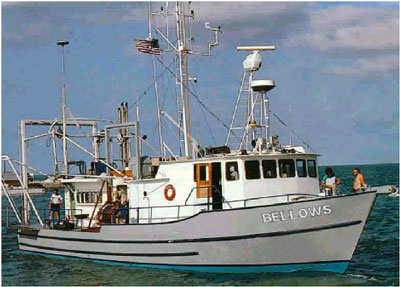 Bellows |
| Title | Survey Equipment | Description |
|---|---|---|
| Cruise report | (document not focused on specific equipment) | Chief Scientist's cruise report of personnel, equipment, brief tabulation of data, and track chart. Also includes the NOAA general cruise inventory. |
| Survey Equipment | Survey Info | Data Type(s) | Data Collected |
|---|---|---|---|
| Boomer | --- | Boomer | |
| EG&G 234 | --- | Boomer | |
| Alpine Vibracorer | --- | Geology | |
| Grab sampler | --- | Biology Geology | |
| SCUBA | --- | Biology Chemistry Geology | |
| Loran-C | --- | Navigation | 1982-014-FA-LN-001 (Digital tape(s) of NV, ) 1982-014-FA-LN-001-01 (BELLOWS 82-1 Track Map (pdf file) West Florida Shelf composite track map including GYRE 81-8 (FA 81012), May 15-20, 1981; LONGHORN 81-1 (FA 81015), May 27-June 9, 1981; SEA ANGEL (no FA #), Aug 10?-29?, 1981; and BELLOWS (FA 82014), May 24-June 6, 1982.) |
