Other ID: 82-G-9
Status: Completed
Organization(s): USGS, Woods Hole Coastal and Marine Science Center
Funding Program(s):
Principal Investigator(s): Dennis W. O'Leary
Affiliate Investigator(s):
Information Specialist(s):
Data Type(s): Imagery: Photo, Seismics: Sub Bottom Profiler, Seismics: Sparker, Seismics: Air Gun / Water Gun, Seismics: Boomer, Seismics: Bubble Gun, Sampling: Geology, Location-Elevation: Navigation
Scientific Purpose/Goals: Obtain color photographs of features interpreted from previously acquired data to represent sites of mass movement; acquire single-channel high-resolution seismic profiles along the photo traverses; and acquire gravity core samples of the photographed bottom at selected sites.
Vehicle(s):
Start Port/Location: Woods Hole, MA
End Port/Location: Woods Hole, MA
Start Date: 1982-08-08
End Date: 1982-08-21
Equipment Used: Camera- deep sea, ORE 140 transceiver/1036 transducer sub-bottom profiler, Teledyne single-channel 300-500J 40-tip minisparker, Teledyne 28420 hydrophone, Hydroplastic corer, Western Geophysical Integrated Navigation System
Information to be Derived: Samples and chemical analysis;
Summary of Activity and Data Gathered: This cruise successfully accomplished its objectives. ANGUS photos were taken at 20 second intervals at 6-7 m above sea floor, the three synchronized cameras taking overlapping photos including an area as great as 450 sq. m. There was no photo overlap at nominal cruising speed of 0.75 knots. 6 nm of data were lost during the last day of the survey because heavy seas prevented safe launch of the camera vehicle. During times when the camera vehicle batteries were being recharged, we retraced the camera track with the minisparker in tow to obtain sub-bottom data along track. At selected sites along photo tracks the corer was deployed to obtain bottom samples. A dredge haul was made to identify a distinctive cliff-forming rock unit. ANGUS photography: 271 km; 3.5 kHz: 32.4 km; Minisparker: 241.4 km; 20 stations (19 core sites and 1 chain bag dredge).
Staff: Gregory Miller, Kathryn Scanlon Catanach, Charles J. O'Hara, Dennis W. O'Leary, Ronald C. Circe, John M. Aaron, Carol M. Parmenter, Robert F. Bowles, James E. Dodd
Affiliate Staff:
WHOI: Earl Young
John Porteus
George Meier
Robert Handy
Carol Collins
Notes:
Project = N. Atlantic Continental Slope Mapping, N. Atlantic Continental Slope Mapping
Location:
Alvin Canyon, Atlantis Canyon, Gilbert Canyon, Lydonia Canyon, Munson Canyon, Continental Slope, Bear Seamount, United States, North America, North Atlantic;
| Boundaries | |||
|---|---|---|---|
| North: 40.52168726 | South: 39.70436899 | West: -70.75557975 | East: -66.66751014 |
Platform(s):
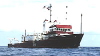
 Gyre |
| Title | Survey Equipment | Description |
|---|---|---|
| Cruise report | (document not focused on specific equipment) | Chief Scientist's cruise report including personnel, equipment notes, data acquisition information, core locations. |
| Survey Equipment | Survey Info | Data Type(s) | Data Collected |
|---|---|---|---|
| Camera- deep sea | --- | Photo | 1982-028-FA-PH-001 (film collection of TRIPOD 264; 19820812-19821111) 1982-028-FA-SE-002 (microfilm of ANGUS) |
| ORE 140 transceiver/1036 transducer sub-bottom profiler | --- | Sub Bottom Profiler | 1982-028-FA-SE-001 ( Collection of paper record displays of seismic data( 12K) for lines ) 1982-028-FA-SE-003 (analog tape of seismic data) |
| Teledyne single-channel 300-500J 40-tip minisparker | --- | Sparker | |
| Teledyne 28420 hydrophone | --- | Air Gun / Water Gun Boomer Bubble Gun Sparker Sub Bottom Profiler | |
| Hydroplastic corer | --- | Geology | |
| Western Geophysical Integrated Navigation System | --- | Navigation | 1982-028-FA-LN-002 (Digital tape(s) of NV-INS, NV-INS-UNEDIT, NV-INS-FINAL, ) 1982-028-FA-LN-001 (Navigation trackline plot for field activity 82028) |