Other ID: GY-83-12
Status: Completed
Organization(s): USGS, Woods Hole Coastal and Marine Science Center
Funding Program(s):
Principal Investigator(s): Anne M. Trehu
Affiliate Investigator(s):
Information Specialist(s):
Data Type(s): Location-Elevation: Navigation, Seismics: Air Gun / Water Gun, Seismics: Multichannel, Seismics: Ocean Bottom Seismometer, Seismics: Sub Bottom Profiler, Sampling: Geology
Scientific Purpose/Goals: Collect airgun ocean-bottom seismometer (OBIP) refraction and multichannel reflection data along lines to be used for long range explosive refraction profiles next spring, in an effort to determine the structure of the crust beneath the Carolina Trough and in the transition zone from the marginal basin to oceanic crust.
Vehicle(s):
Start Port/Location: Woods Hole, MA
End Port/Location: Miami, FL
Start Date: 1983-09-22
End Date: 1983-10-06
Equipment Used: Multichannel seismics, Air gun, 3.5 kHz, Gravity corer, Integrated Navigation System, Ocean Bottom Seismometer
Information to be Derived:
Summary of Activity and Data Gathered: 400 km single-channel digital seismic reflection; 210 km multichannel reflection and OBIP refraction; 700 km 3.5-kHz echo sounding; 1 mooring deployed and recovered (#272, current meter). Total for continuous data field is sum of all data gathered.
Staff: Dann Blackwood, Candy Bostwick, Jack Connell, Raymond E. Davis, James E. Dodd, David W. Folger, Barry Irwin, Gus Lamarre, David Nichols, William J. Strahle
Affiliate Staff:
Greg Jennings - Eliason Data; Jay Pulliam
Notes: Original Center People field contained: Dann Blackwood, Jack Connell, Raymond Davis, James Dodd, Dave Folger, Barry Irwin, Candy Lane, Gus Lamarre, Dave Nichols, Jay Pulliam, William Strahle.
Project = Continental margin deep crustal and seismicity studies, Continental margin deep crustal and seismicity studies
Location:
Carolina Trough, offshore Florida, southern Blake Plateau, United States, North America, North Atlantic;
| Boundaries | |||
|---|---|---|---|
| North: 36 | South: 27 | West: -80.5 | East: -75 |
Platform(s):
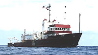
 Gyre |
| Title | Survey Equipment | Description |
|---|---|---|
| Cruise report | (document not focused on specific equipment) | Chief Scientist's cruise report including personnel list, cruise summary, equipment list, station locations and information, and track charts. |
| Survey Equipment | Survey Info | Data Type(s) | Data Collected |
|---|---|---|---|
| Multichannel seismics | --- | Multichannel | 1983-008-FA-SE-002 (microfilm of ) 1983-008-FA-SE-003-01 (SEGY seismic data rescued from 9 track tape) |
| Air gun | --- | Air Gun / Water Gun | |
| 3.5 kHz | --- | Sub Bottom Profiler | 1983-008-FA-SE-001 ( Collection of paper record displays of seismic data( 3.5K) for lines ) |
| Gravity corer | --- | Geology | |
| Integrated Navigation System | --- | Navigation | 1983-008-FA-LN-002 (Digital tape(s) of NV-TRANSIT, NV-LINES 1-3, NV-LINES 4,5,1A, NV-LINES 1-5,1A, NV-INS, OBIP, ) 1983-008-FA-LN-001 (Navigation trackline plot for field activity 83008) |
| Ocean Bottom Seismometer | --- | Ocean Bottom Seismometer | 1983-008-FA-SE-003 (Digital tape(s) of NV-TRANSIT, NV-LINES 1-3, NV-LINES 4,5,1A, NV-LINES 1-5,1A, NV-INS, OBIP, ) |