Other ID: 83-G-13
Status: Completed
Organization(s): USGS, Woods Hole Coastal and Marine Science Center
Funding Program(s):
Principal Investigator(s): Mahlon M. Ball
Affiliate Investigator(s):
Information Specialist(s):
Data Type(s): Seismics: Multichannel, Electro-Magnetic: Gravity, Seismics: Sub Bottom Profiler, Electro-Magnetic: Magnetics, Location-Elevation: Navigation, Seismics: Air Gun / Water Gun
Scientific Purpose/Goals: Make geophysical measurements (CDP seismic, 3.5 kHz, gravity, and magnetics) to be used in regional structural and stratigraphic framework studies. Loss of the ship's main engine caused a cessation of this cruise following completion of signature tests, but before any work could be done.
Vehicle(s):
Start Port/Location: Miami, FL
End Port/Location: Pensacola, FL
Start Date: 1983-10-11
End Date: 1983-10-15
Equipment Used: Multichannel seismics, Water gun (wh), Bell Aerospace BGM-3 gravimeter, 3.5 kHz, Varian V-75 magnetometer, Loran-C, Sonar Doppler, Gyro compass, Magnavox satellite positioning system
Information to be Derived: Morphology;
Summary of Activity and Data Gathered: Loss of the ship's main engine caused a cessation of this cruise following completion of signature tests, but before any work could be done. No data collected; only signature test completed.
Staff: Deborah Hutchinson, Barry Irwin, Barbara Ann McKinney, David Nichols, Mahlon M. Ball, James E. Dodd, Elizabeth Coward, Gus Lamarre, Jack Connell
Affiliate Staff:
USGS-Denver: Jim Leinbach - Watchstander
Bill Patterson - Watchstander
Dick Wise - Watchstander
Nick Zihlman - Watchstander; Consultant: Jim Hedger - Water Gun Tech.
Notes: Original Center People field contained: Mahlon Ball - Ch. Sci./Geophysicist, Dave Nichols - Geophysicist, Jack Connell - Geophysicist, Jim Dodd - Geophysicist, Barry Irwin - Geophysicist, Gus Lamarre - Geophysicist, Debbie Hutchinson-Gove - Watchstander, Ann Swift - Watchstander, Betsy Miller - Watchstander. Original Submitted By field contained: Mahlon Ball, Debbie Hutchinson-Gove.
Project = Regional structure and stratigraphy of the western Florida shelf - MAFLA area, Regional structure and stratigraphy of the western Florida shelf - MAFLA area
Location:
western Florida shelf, Florida, Gulf of America (Gulf of Mexico), United States, North America, North Atlantic;
| Boundaries | |||
|---|---|---|---|
| North: 30 | South: 25.5 | West: -87.5 | East: -82.5 |
Platform(s):
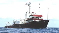
 Gyre |
| Title | Survey Equipment | Description |
|---|---|---|
| Cruise report | (document not focused on specific equipment) | Chief Scientist's cruise report including personnel, equipment notes and configuration, ship movement, track maps, and co-Chief Scientist's signature test report. |
| Survey Equipment | Survey Info | Data Type(s) | Data Collected |
|---|---|---|---|
| Multichannel seismics | --- | Multichannel | |
| Water gun (wh) | --- | Air Gun / Water Gun | |
| Bell Aerospace BGM-3 gravimeter | --- | Gravity | |
| 3.5 kHz | --- | Sub Bottom Profiler | |
| Varian V-75 magnetometer | --- | Magnetics | |
| Loran-C | --- | Navigation | 1983-009-FA-LN-001 (Digital tape(s) of NV, ) |
| Sonar Doppler | --- | Navigation | |
| Gyro compass | --- | Navigation | |
| Magnavox satellite positioning system | --- | Navigation |