Other ID: none
Status: Completed
Organization(s): USGS, Woods Hole Coastal and Marine Science Center
Funding Program(s):
Principal Investigator(s): John Moody
Affiliate Investigator(s):
Information Specialist(s):
Data Type(s): Imagery: Photo, Time Series: Mooring (physical oceanography)
Scientific Purpose/Goals: Deploy tripod #287 and subsurface mooring #288; collect mud grab samples.
Vehicle(s):
Start Port/Location: Woods Hole, MA
End Port/Location: Woods Hole, MA
Start Date: 1984-10-25
End Date: 1984-10-25
Equipment Used: Camera- deep sea, Bottom platform
Information to be Derived: Time series data;Samples and chemical analysis;
Summary of Activity and Data Gathered: Moorings deployed: 2 (#287 and 288 recovered FA 85001 ASTERIAS Jan. 14, 1985). Mud grab samples collected.
Staff: John Larson, John Moody, Joseph S. Newell, William J. Strahle
Affiliate Staff:
WHOI: Val Wilson
Charlotte Fuller
Notes:
Location:
East Phinney Rock, Buzzards Bay, Massachusetts, United States, North America, North Atlantic;
| Boundaries | |||
|---|---|---|---|
| North: 41.55556 | South: 41.49572105 | West: -70.8772 | East: -70.76911926 |
Platform(s):
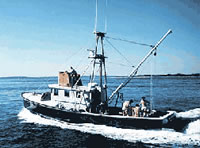
 Asterias |
Butman, B., Signell, R., Shoukimas, P., and Beardsley, R.C., 1988, Current observations in Buzzards Bay, Massachusetts, 1982-1986; data report: U.S. Geological Survey Open-File Report 88-5, 211 p., URL: https://doi.org/10.3133/ofr885.
| Title | Survey Equipment | Description |
|---|---|---|
| Cruise report | (document not focused on specific equipment) | Brief Chief Scientist's report including personnel, narrative, and map of mooring locations. |
| Survey Equipment | Survey Info | Data Type(s) | Data Collected |
|---|---|---|---|
| Camera- deep sea | --- | Photo | 1984-021-FA-PH-001 (film collection of TRIPOD 287; 19841025-19850114) |
| Bottom platform | --- | Mooring (physical oceanography) | 1984-021-FA-OM-001 (Buzzards Bay mooring data) |