Other ID: DISC-85-1
Status: Completed
Organization(s): USGS, Woods Hole Coastal and Marine Science Center
Funding Program(s):
Principal Investigator(s): S. Jeffress Williams
Affiliate Investigator(s): Randy Kerhin - MGS (Apr. 28 - May 4); Carl Hobbs - VIMS (Apr. 28 - May 5)
Information Specialist(s): S. Jeffress Williams
Data Type(s): Seismics: Boomer, Seismics: Sub Bottom Profiler, Sonar: Sidescan, Seismics: Air Gun / Water Gun, Seismics: Bubble Gun, Seismics: Sparker, Location-Elevation: Navigation
Scientific Purpose/Goals: Collect high-resolution seismic reflection and sidescan sonar data to define and charcterize the shallow sub-bottom stratigraphy, seabed morphology and sediment distribution, with particular emphasis on the linear shoal features. Interpretation of these data in conjunction with core information will help to better understand the sedimentary framework and geologic history and processes of the nearshore region. These data will provide baseline information including late Quaternary sea level rise with possible applications to predicted future rises and its effects on the highly developed Ocean City barrier island, origin and evolution of linear sand shoals, seaward extension of possible fresh water aquifers, and location and extent of marine hard mineral resources.
Vehicle(s):
Start Port/Location: Ocean City, MD
End Port/Location: Ocean City, MD
Start Date: 1985-04-28
End Date: 1985-05-11
Equipment Used: ORE GeoPulse, EG&G 234, Datasonics SST 220 sub-bottom 3.5k, EG&G Model SMS 960 Seafloor Mapping System, Innerspace Technology 25-element hydrophone, Loran-C
Information to be Derived:
Summary of Activity and Data Gathered: The cruise was a success in spite of considerable down time the first week due to a nor'easter, persistent problems with survey equipment, and noise interference on the records from the ship's generator. Our salvation the second week was a combination of a stationary high pressure system resulting in placid seas, the competence and persistence of Ken Parolski to troubleshoot, adjust and repair the equipment, and the willingness of all to work extra long days. The result was that more than 550 km (306 nm) of seismic trackline profiles were collected on 34 transects. The transects are arranged in a grid pattern, shore normal and parallel, extending from the shoreface to 22 km offshore. Coverage by sidescan sonar is limited to about one half the tracks because the unit broke midway through the second week and was unrepairable. In general the profiles exhibit good resolution of stratigraphic detail and excellent penetration through the Quaternary section and in some cases well down through Tertiary reflectors. Profiles from the Datasonics (3.5 kHz) and the Boomers complement each other. The 3.5 profiles show good detail for several uppermost reflectors underlying the linear shoals and within the sand bodies, as well as channel-like features incised into the presumed pre-Holocene surface. The Boomer profiles show penetrations on the order of 80 m with several broad and low-relief horizons that should be traceable to onshore well borings and exposures. The sidescan showed a patchy distribution of sediments with bedforms of varying dimensions apparently common on shoal areas.
Staff: Kenneth F. Parolski
Affiliate Staff:
Malcolm Green - VIMS (May 5-10); Bob Cuthberson - MGS (May 5-11)
Notes:
Project = Geologic Framework and Sedimentary Character of the Middle Atlantic Coast and Continental Shelf, Geologic Framework and Sedimentary Character of the Middle Atlantic Coast and Continental Shelf
Location:
Middle Atlantic nearshore region, Delaware Bay entrance to Fishing Point, Virginia, United States, North America, North Atlantic;
| Boundaries | |||
|---|---|---|---|
| North: 38.83333 | South: 37.8 | West: -75.1 | East: -74.4 |
Platform(s):
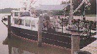
 Discovery |
| Title | Survey Equipment | Description |
|---|---|---|
| Cruise report | (document not focused on specific equipment) | Chief Scientist's cruise including personnel, purpose, equipment, cruise summary and trackmap. |
| Survey Equipment | Survey Info | Data Type(s) | Data Collected |
|---|---|---|---|
| ORE GeoPulse | --- | Boomer | |
| EG&G 234 | --- | Boomer | |
| Datasonics SST 220 sub-bottom 3.5k | --- | Sub Bottom Profiler | |
| EG&G Model SMS 960 Seafloor Mapping System | --- | Sidescan | 1985-010-FA-SO-001 (microfilm of ) |
| Innerspace Technology 25-element hydrophone | --- | Air Gun / Water Gun Boomer Bubble Gun Sparker | 1985-010-FA-SE-001 (analog tape of seismic data) |
| Loran-C | --- | Navigation | 1985-010-FA-LN-001 (Digital tape(s) of NV, RAW NV, ) |