Other ID: STRL S8-87-AFR
Status: Completed
Organization(s): USGS, Woods Hole Coastal and Marine Science Center
Funding Program(s):
Principal Investigator(s): Catherine Delorey
Affiliate Investigator(s):
Information Specialist(s): Catherine Delorey
Data Type(s): Electro-Magnetic: Gravity, Sonar: Single Beam, Electro-Magnetic: Magnetics, Location-Elevation: Navigation
Scientific Purpose/Goals: Collect gravity, magnetics and bathymetric data in and around the waters of Equatorial Guinea and Gabon as specified by DMA requirements.
Vehicle(s):
Start Port/Location: Douala, Cameroon
End Port/Location: Abidjan, Cote d'Ivoire
Start Date: 1987-10-22
End Date: 1987-11-04
Equipment Used: LaCoste-Romberg gravimeter G-179, 12 kHz, Geometrics G-856 magnetometer, GE 810 Correlation sonar, Gyro compass, GPS (wh)
Information to be Derived:
Summary of Activity and Data Gathered: The ship departed Doula and proceeded to surops area on 22 Oct. 1987. Upon completion of lines begun on previous leg S7-87-AFR in the waters off Gabon, the ship headed northward to complete lines off Equatorial Guinea. Several lines in both survey areas were shortened on landward end due to shoals. The presence of oil rigs required further adjustments of lines in both regions. Surveying was completed on 31 Oct. 1987 followed by a three-day transit to Abidjan where the ship docked on 4 Nov. 1987. Final gravity land ties were completed in Abidjan on 5 Nov. to tie ship meter data with a known gravity station and to verify the accuracy of two previous land ties performed in the same area.
Staff: Catherine Delorey, Carol A. Ryland
Affiliate Staff:
Linda Sheetz; William Wright - USGS
Reston
Notes: Original Center People field contained: Catherine Delorey - Ch. Sci., Carol Renaud, Linda Sheetz.
Project = Defense Mapping Agency Gravity, Defense Mapping Agency Gravity
Location:
Gabon, Equatorial Guinea, Africa, North Atlantic, South Atlantic;
| Boundaries | |||
|---|---|---|---|
| North: 4.5 | South: 3.5 | West: 8 | East: 11 |
Platform(s):
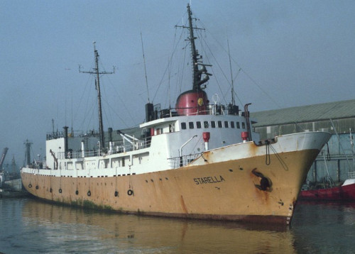
 Starella |
Folger, D.W., McCullough, James R., Irwin, Barry J., Driscoll, George R., Delorey, Catherine M., and Polloni, Christopher F., 1990, Map showing free-air gravity anomalies off the western coast of Africa; Nigeria to Gabon: U.S. Geological Survey Miscellaneous Field Studies Map MF-2098-F, scale 1:1,500,000, URL: https://pubs.er.usgs.gov/publication/mf2098F.
| Title | Survey Equipment | Description |
|---|---|---|
| Cruise report | (document not focused on specific equipment) | Chief Scientist's report including personnel, purpose, equipment, tabulated information, brief narrative, and trackmaps. |
| Survey Equipment | Survey Info | Data Type(s) | Data Collected |
|---|---|---|---|
| LaCoste-Romberg gravimeter G-179 | --- | Gravity | |
| 12 kHz | --- | Single Beam | 1987-042-FA-SE-001 ( Collection of paper record displays of seismic data (12K) for lines ) |
| Geometrics G-856 magnetometer | --- | Magnetics | |
| GE 810 Correlation sonar | --- | Navigation | |
| Gyro compass | --- | Navigation | |
| GPS (wh) | --- | Navigation |