Other ID: ACAD 88-01
Status: Completed
Organization(s): USGS, Woods Hole Coastal and Marine Science Center
Funding Program(s):
Principal Investigator(s): S. Jeffress Williams
Affiliate Investigator(s): Shea Penland, LGS
Information Specialist(s):
Data Type(s): Seismics: Boomer, Seismics: Sub Bottom Profiler, Location-Elevation: Navigation
Scientific Purpose/Goals: Map and interpret the shallow morphostratigraphy of the delta plain using seismics and cores. This cruise is a continuation (3rd year of the USGS-LGS co-op on barrier island erosion) of the high-resolution seismic reflection profiling on the nearshore and inner shelf west of the Mississippi River delta.
Vehicle(s):
Start Port/Location: Cocodrie, LA
End Port/Location: Cocodrie, LA
Start Date: 1988-07-19
End Date: 1988-07-26
Equipment Used: ORE GeoPulse, EG&G 234, ODEC 3.5 kHz, Loran-C
Information to be Derived:
Summary of Activity and Data Gathered: High-resolution seismic reflection profiling on the nearshore and inner shelf west of the Mississippi River delta.
Staff: David Nichols, S. Jeffress Williams
Affiliate Staff:
Lee Black - LUMCON
Captain; Wayne Simoneaux - LUMCON
First Mate; Shea Penland
LGS
co-Ch. Sci.; Rick Vail - USGS-PMG
Technician; Randy McBride - LGS
Scientist; Greg Taylor - LGS
Technician; David Pope - LGS
Technician
Notes: Original Center People field contained: Jeff Williams - Ch. Sci.; Dave Nichols - Technician.
Project = Louisiana Barrier Island Study, Louisiana Barrier Island Study
Location:
central Louisiana coast and inner shelf, west of Mississippi River delta, Gulf of America (Gulf of Mexico), United States, North America, North Atlantic;
| Boundaries | |||
|---|---|---|---|
| North: 29.2861327 | South: 28.25 | West: -90.89415025 | East: -89.26 |
Platform(s):
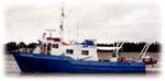 Acadiana |
| Title | Survey Equipment | Description |
|---|---|---|
| Cruise report | (document not focused on specific equipment) | Chief Scientist's cruise report including personnel, purpose, equipment, tabulated information, and track chart. |
| Survey Equipment | Survey Info | Data Type(s) | Data Collected |
|---|---|---|---|
| ORE GeoPulse | --- | Boomer | |
| EG&G 234 | --- | Boomer | |
| ODEC 3.5 kHz | --- | Sub Bottom Profiler | |
| Loran-C | --- | Navigation | 1988-008-FA-LN-001-01 (Navigation data recovered from 9 track tape) 1988-008-FA-LN-001-02 (Navigation data ) |
