Other ID: NECH 88-1-LM
Status: Completed
Organization(s): USGS, Woods Hole Coastal and Marine Science Center
Funding Program(s):
Principal Investigator(s): David W. Folger, David Foster
Affiliate Investigator(s):
Information Specialist(s):
Data Type(s): Seismics: Boomer, Sonar: Sidescan, Sonar: Single Beam, Environmental Data: Tide, Location-Elevation: Navigation
Scientific Purpose/Goals: To determine the seismic stratigraphy above bedrock on 24 transects from 10 NM offshore to the coasts of Illinois and Indiana.
Vehicle(s):
Start Port/Location: Great Lakes, IL
End Port/Location: Michigan City, IN
Start Date: 1988-07-25
End Date: 1988-08-11
Equipment Used: Single channel hydrophone, Huntec profiling system (500-2500 Hz), Klein 531 sidescan, ODOM 200 kHz depth recorder, Water-level gauges, Motorola Falcon IV Microwave relay Mini-Ranger
Information to be Derived:
Summary of Activity and Data Gathered: 350 nm (648 km) bathymetry and sub-bottom data. Sidescan data will have to be acquired when the thermocline is destroyed by fall storms and cold weather.
Staff: David Foster, Barry Irwin, David Mason, David Nichols, Thomas O'Brien, Christopher F. Polloni, Kenneth F. Parolski, David W. Folger
Affiliate Staff:
Thorton Tyson; Richard Tagg - USGS-Menlo Park
Notes: Original Center People field contained: Dave Folger, Dave Foster, Tom O'Brien, Barry Irwin, Chris Polloni, Ken Parolski, Dave Nichols, Dave Mason, Thorton Tyson.
Project = Southern Lake Michigan Study, Southern Lake Michigan Study
Location:
Southern Lake Michigan, Great Lakes, Illinois, Indiana, United States, North America;
| Boundaries | |||
|---|---|---|---|
| North: 42.5 | South: 41.5 | West: -87.84 | East: -86.83 |
Platform(s):
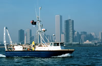
 Neecho |
Foster, D.S., and Colman, S.M., 1991, Preliminary interpretation of the high-resolution seismic stratigraphy beneath Lake Michigan: U.S. Geological Survey Open-File Report 91-021, https://doi.org/10.3133/ofr9121.
| Title | Survey Equipment | Description |
|---|---|---|
| Cruise report | (document not focused on specific equipment) | Chief Scientist's report including personnel, purpose, equipment, tabulated information, trackmap, and table of seismic lines including start and end times and date. |
| Sidescan log | Klein 531 sidescan | Log of sidescan sonar lines - start and end of line and tape. Also includes comments about the Huntec system. Log book covers 2 cruises (1988-009-FA and 1988-012-FA). |
| Survey Equipment | Survey Info | Data Type(s) | Data Collected |
|---|---|---|---|
| Single channel hydrophone | --- | Air Gun / Water Gun Boomer Bubble Gun Sparker Sub Bottom Profiler | 1988-009-FA-SE-002 (analog tape of seismic data) 1988-009-FA-SE-001 (microfilm of) |
| Huntec profiling system (500-2500 Hz) | --- | Boomer | |
| Klein 531 sidescan | --- | Sidescan | 1988-009-FA-SO-001 ( Collection of paper record displays of sidescan sonar data for lines ) |
| ODOM 200 kHz depth recorder | --- | Single Beam | 1988-009-FA-BA-001 (Digital tape(s) of NV/BT-MINIRANGER, ) |
| Water-level gauges | --- | Tide | |
| Motorola Falcon IV Microwave relay Mini-Ranger | --- | Navigation | 1988-009-FA-LN-001-01 (Huntec subbottom profiler trackline map.) 1988-009-FA-LN-002 (Digital tape(s) of NV/BT-MINIRANGER, ) |