Other ID: PLSTAR-1; P-1-88-AR
Status: Completed
Organization(s): USGS, Woods Hole Coastal and Marine Science Center
Funding Program(s):
Principal Investigator(s): David Nichols
Affiliate Investigator(s): Art Grantz, PMG
Information Specialist(s):
Data Type(s): Seismics: Sub Bottom Profiler, Sonar: Sidescan, Biological Field Study: Experiments (biological), Sampling: Biology, Sampling: Geology, Location-Elevation: Navigation
Scientific Purpose/Goals: To gather digital seismic reflection and refraction data and to ground truth the Chuckchi Borderland area.
Vehicle(s):
Start Port/Location: Nome, AK
End Port/Location: Barrows, AK
Start Date: 1988-08-30
End Date: 1988-09-29
Equipment Used: Piston corer, Gravity corer, Edo Western Sidescan and 2.5 kHz sub-bottom system, Box corer, GPS (wh), Loran-C
Information to be Derived:
Summary of Activity and Data Gathered:
Staff: David Nichols
Affiliate Staff:
PMG: Art Grantz
Larry Phillips
Erk Reimeitz
Jim Vaughan
John Gann
Jon Childs
Kevin O'Toole
Jeff Stampher
Bill La Fleur
Dave Dinter
Pat Hart; Alaska Branch: Mike Mullen
Steve May; WHOI: Alan Gagnon
Notes: All data archived by Pacific Marine Geology division.
Information from Foghorn: DFS V, Airguns, Sonobuoys, SUS Charges, Piston core, gravity core, box core;
Location:
Chukchi Sea, Alaska, United States, North America, Arctic Ocean;
| Boundaries | |||
|---|---|---|---|
| North: 75.19327895 | South: 66.82267772 | West: -168.75 | East: -153.73122405 |
Platform(s):
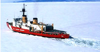 Polar Star |
| Title | Survey Equipment | Description |
|---|---|---|
| Cruise report | (document not focused on specific equipment) | Sparse Chief Scientist's report including personnel, equipment, and a sentence describing the purpose. |
| Survey Equipment | Survey Info | Data Type(s) | Data Collected |
|---|---|---|---|
| Piston corer | --- | Geology | |
| Gravity corer | --- | Geology | |
| Edo Western Sidescan and 2.5 kHz sub-bottom system | --- | Sub Bottom Profiler Sidescan | |
| Box corer | --- | Biology Geology | |
| GPS (wh) | --- | Navigation | |
| Loran-C | --- | Navigation | 1988-013-FA-LN-001 (Navigation data) |
