Other ID: LAUR89-2
Status: Completed
Organization(s): USGS, Woods Hole Coastal and Marine Science Center
Funding Program(s):
Principal Investigator(s): Stephen Colman
Affiliate Investigator(s):
Information Specialist(s):
Data Type(s): Sampling: Biology, Sampling: Geology, Seismics: Sub Bottom Profiler, Seismics: Boomer, Seismics: Air Gun / Water Gun, Seismics: Sparker, Location-Elevation: Navigation
Scientific Purpose/Goals: Collection of seismic reflection data and cores in Lake Michigan to define the stratigraphy and sediment character of the deposits below the lake floor. The last year's seismic reflection data was used to choose core locations for this cruise and to define areas where new seismic reflection data were needed. New gravity and box cores were obtained at most of the sites that were piston cored or vibracored last year, and a number of new core sites were established. These cores will be used to develop a closely dated record of sedimentation and paleoenvironmental conditions in the lake. The cores and the seismic reflection data together will be used to determine the history of lake-level fluctuations over the last several thousand years.
Vehicle(s):
Start Port/Location: Grand Haven, MI
End Port/Location: Grand Haven, MI
Start Date: 1989-06-19
End Date: 1989-06-22
Equipment Used: Gravity corer, Box corer, ORE 140 transceiver/1036 transducer sub-bottom profiler, Boomer, Benthos AQ-4 10-element hydrophone streamer, Megapulse Accufix 500 LORAN-C
Information to be Derived: Grain size analysis;Morphology;
Summary of Activity and Data Gathered: This cruise was done in two legs: first leg June 13-18 (FA 89015); second leg June 19-22 (FA 89016). FA 89015 collected cores from Sites 1 thru 7, 9, 11 thru 13, 20, 22, and 23; FA 89016 collected cores from Sites 24 thru 31. Box cores: 10; Gravity cores: 8; Seismic tracklines: 14.
Staff: David Foster, Stephen Colman, Kenneth F. Parolski
Affiliate Staff:
Dan Block - NAGT student
Tom Davis - WHOI
Notes: Original Center People field contained: Steve Colman - Ch. Sci., Dave Foster, Kenneth Parolski - technician.
Project = Lake Level and Sedimentation History (LLASH), Lake Level and Sedimentation History (LLASH)
Location:
Lake Michigan, Michigan, Wisconsin, Great Lakes, United States, North America;
| Boundaries | |||
|---|---|---|---|
| North: 44.58786103 | South: 41.75 | West: -87.63409999 | East: -86.25 |
Platform(s):
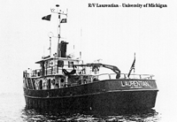 Laurentian |
Colman, S.M., and Foster, D.S., 1990, Stratigraphy, descriptions and physical properties of sediments cored in Lake Michigan: U.S. Geological Survey Open-File Report 90-478, https://doi.org/10.3133/ofr90478.
Foster, D.S., and Colman, S.M., 1991, Preliminary interpretation of the high-resolution seismic stratigraphy beneath Lake Michigan: U.S. Geological Survey Open-File Report 91-021, https://doi.org/10.3133/ofr9121.
| Title | Survey Equipment | Description |
|---|---|---|
| Cruise report | (document not focused on specific equipment) | Chief Scientist's cruise report including personnel, purpose, equipment and equipment performance, cruise summary, trackmap, seismic line list, and core locations. Covers 1989-015-FA and 1988-016-FA. |
| Cruise log | (document not focused on specific equipment) | Chief Scientist's handwritten cruise log of daily operations and data collection (covers 1989-015 and 1989-016). Log of seismic data acquisition including settings, line changes, tape changes, and comments. |
| Data inventory | (document not focused on specific equipment) | Cruise Curator's inventory of field data items. Covers 1989-015-FA and 1989-016-FA. |
| Survey Equipment | Survey Info | Data Type(s) | Data Collected |
|---|---|---|---|
| Gravity corer | --- | Geology | |
| Box corer | --- | Biology Geology | 1989-016-FA-SC-001 (CORE samples) |
| ORE 140 transceiver/1036 transducer sub-bottom profiler | --- | Sub Bottom Profiler | |
| Boomer | --- | Boomer | |
| Benthos AQ-4 10-element hydrophone streamer | --- | Air Gun / Water Gun Boomer Sparker | 1989-016-FA-SE-001-01 (Scanned Seismic Lines - 3.5 kHz) 1989-016-FA-SE-001 (Collection of paper record displays of seismic data( 3.5K) for lines) 1989-016-FA-SE-003 (microfilm of ) 1989-016-FA-SE-002 (VHS digital tapes for line(s) 38, 38, 38, 38, 38, 38, 38, 38-39, 39, 39, 39, 39, 39-40, 40, 40, 40, 40-41, 41, 41-42, 42, 42-43, 43-45, 45-46, 47-48, 48, 48-49, 49-50, 50, 51, ) 1989-016-FA-SE-001-02 (Scanned Seismic Lines - Geopulse) |
| Megapulse Accufix 500 LORAN-C | --- | Navigation | 1989-016-FA-LN-002-01 (June 19 (txt file) Navigation data.) 1989-016-FA-LN-001-01 (Box and piston core locations and Geopulse trackline map.) 1989-016-FA-LN-002-02 (June 20 (txt file) Navigation data.) 1989-016-FA-LN-001 (Navigation trackline plot for field activity 89016) |
