Other ID: NE-1-90
Status: Completed
Organization(s): USGS, Woods Hole Coastal and Marine Science Center
Funding Program(s):
Principal Investigator(s): James S. Booth
Affiliate Investigator(s):
Information Specialist(s):
Data Type(s): Sampling: Chemistry, Sampling: Biology, Sampling: Geology, Sonar: Single Beam, Location-Elevation: Navigation, Environmental Data: Sediment Properties
Scientific Purpose/Goals: Collect in situ data on sand density, statigraphy and penetration resistance of lake floor, and photograph lake floor (SCUBA divers); conduct bathymetric survey and collect grab and gravity core samples of nearshore zone; and examine wave and sand transport effects on and around engineering structures.
Vehicle(s):
Start Port/Location: North Point Marina, IL
End Port/Location: Waukegan, IL
Start Date: 1990-08-01
End Date: 1990-08-08
Equipment Used: Water sampler, Miniature Standard Penetrometer, Push corer (wh), Shipek grab, Gravity corer, ODOM 200 kHz depth recorder, Motorola Mini-Ranger III, Loran-C
Information to be Derived:
Summary of Activity and Data Gathered: 38 lines bathymetric data; 8 in situ SCUBA diver stations; 9 grab or core stations.
Staff: Dann Blackwood, William Winters, Kenneth F. Parolski
Affiliate Staff:
Ron Circe - USGS
Reston
Notes: Project = Southern Lake Michigan, Southern Lake Michigan
Information from Foghorn: ln situ volumetric sampler, Miniature Standard Penetrometer, Diver corer, Camera, Shipek grab sampler, Gravity Corer, Odom 3200 Echo Trac, Mini-Ranger Falcon IV system, Megapulse 500 LORAN-C system;
Location:
nearshore region off Fort Logan and Illinois Beach State Park, North Point Marina, southern Lake Michigan, Illinois, Great Lakes, United States, North America;
| Boundaries | |||
|---|---|---|---|
| North: 42.5 | South: 42.3 | West: -87.9 | East: -87.7 |
Platform(s):
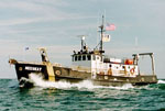 Neeskay |
| Title | Survey Equipment | Description |
|---|---|---|
| Cruise report | (document not focused on specific equipment) | Chief scientist's cruise report including personnel, purpose, equipment, tabulated information, sample locations and descriptions, and trackmap. |
| Survey Equipment | Survey Info | Data Type(s) | Data Collected |
|---|---|---|---|
| Water sampler | --- | Chemistry | |
| Miniature Standard Penetrometer | --- | Sediment Properties | |
| Push corer (wh) | --- | Biology Geology | |
| Shipek grab | --- | Geology | |
| Gravity corer | --- | Geology | |
| ODOM 200 kHz depth recorder | --- | Single Beam | |
| Motorola Mini-Ranger III | --- | Navigation | |
| Loran-C | --- | Navigation |
