Other ID: none
Status: Completed
Organization(s): USGS, Woods Hole Coastal and Marine Science Center
Funding Program(s):
Principal Investigator(s): Page Valentine
Affiliate Investigator(s):
Information Specialist(s):
Data Type(s): Seismics: Sub Bottom Profiler, Imagery: Video, Sonar: Sidescan
Scientific Purpose/Goals: Survey and map herring spawning grounds on crest of Georges Bank.
Vehicle(s):
Start Port/Location: Portsmouth, NH
End Port/Location: Groton, CT
Start Date: 1990-08-24
End Date: 1990-09-06
Equipment Used: 3.5 kHz, Video camera - deep sea, Sidescan sonar
Information to be Derived:
Summary of Activity and Data Gathered:
Staff: Page Valentine
Affiliate Staff:
Greg Lough
NMFS
Notes:
Location:
Eastern Georges Bank, United States, Canada, North America, North Atlantic;
| Boundaries | |||
|---|---|---|---|
| North: 42.55119 | South: 40.34654 | West: -69.2589 | East: -66.09375 |
Platform(s):
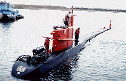 NR-1 |
| Survey Equipment | Survey Info | Data Type(s) | Data Collected |
|---|---|---|---|
| 3.5 kHz | --- | Sub Bottom Profiler | |
| Video camera - deep sea | --- | Video | |
| Sidescan sonar | --- | Sidescan |
