Other ID: CT cruise # AST 90-1
Status: Completed
Organization(s): USGS, Woods Hole Coastal and Marine Science Center
Funding Program(s):
Principal Investigator(s): Robert N. Oldale
Affiliate Investigator(s): Ralph S. Lewis - CT DEP
Information Specialist(s):
Data Type(s): Seismics: Boomer, Seismics: Sub Bottom Profiler, Location-Elevation: Navigation
Scientific Purpose/Goals:
Vehicle(s):
Start Port/Location: Noank, CT
End Port/Location:
Start Date: 1990-09-10
End Date: 1990-09-12
Equipment Used: Single channel hydrophone, Boomer, Loran-C
Information to be Derived:
Summary of Activity and Data Gathered:
Staff: Kenneth F. Parolski
Affiliate Staff:
possible student?; Ralph Lewis
Ch. Sci.
CT DEP
Notes: Original Center People field contained: Kenneth Parolski - ET, possible student?
From Foghorn: Uniboom, GeoPulse, Silent 700 recorder for navigation;
Location:
Fishers Island Sound, Long Island Sound, Connecticut, United States, North America, North Atlantic;
| Boundaries | |||
|---|---|---|---|
| North: 41.3299 | South: 41.20887 | West: -72.1837 | East: -71.85544 |
Platform(s):
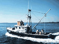
 Asterias |
Poppe, L.J., Paskevich, V.F., Lewis, R.S., and DiGiacomo-Cohen, M.L., 2002, Geological framework data from Long Island Sound, 1981-1990—A digital data release: U.S. Geological Survey Open-File Report 2002-002, https://doi.org/10.3133/ofr022.
| Title | Survey Equipment | Description |
|---|---|---|
| Navigation log | (document not focused on specific equipment) | Navigation log recreated May 14, 2001 from navigation printout and seismic record annotations. |
| Survey Equipment | Survey Info | Data Type(s) | Data Collected |
|---|---|---|---|
| Single channel hydrophone | --- | Air Gun / Water Gun Boomer Bubble Gun Sparker Sub Bottom Profiler | 1990-034-FA-SE-001-01 (Scanned Profiles - 10 scanned record sections in TIFF format.) |
| Boomer | --- | Boomer | |
| Loran-C | --- | Navigation | 1990-034-FA-LN-001-01 (Navigation data) |