Other ID: W4-90
Status: Completed
Organization(s): USGS, Woods Hole Coastal and Marine Science Center
Funding Program(s):
Principal Investigator(s): Michael Bothner
Affiliate Investigator(s):
Information Specialist(s):
Data Type(s): Imagery: Photo, Location-Elevation: Navigation, Sampling: Geology, Time Series: Mooring (physical oceanography)
Scientific Purpose/Goals: Conduct long-term monitoring of currents, sediment transport, and physical/chemical characteristics of sediments in western Massachusetts Bay. Exchange tripod, subsurface mooring and near-surface current meter.
Vehicle(s):
Start Port/Location: USCG Base, Boston, MA
End Port/Location: USCG Base, Boston, MA
Start Date: 1990-10-23
End Date: 1990-10-24
Equipment Used: Slow corer, Van Veen grab sampler, Gravity corer, Sediment traps, Loran-C, Camera- deep sea, Raytheon radar, Bottom platform
Information to be Derived: Time series data; Samples and chemical analysis; Grain size analysis; Suspended sediment concentrations;
Summary of Activity and Data Gathered: Moorings deployed: 2 (#358 and 359, recovered FA 91005 WHITE HEATH Feb. 12-13, 1991). Moorings recovered: 2 (#347 and 348 deployed FA 90016 WHITE HEATH Jul. 10-11, 1990).
Staff: Michael Bothner, Adam Brown, Bradford Butman, Frances Lightsom, Marinna Martini, Magela Moffett, Carol M. Parmenter, Richard Rendigs, William J. Strahle
Affiliate Staff:
MWRA representative
Notes: NO CRUISE REPORT, only detailed pre-cruise report available. Original Center People field contained: Mike Bothner, Adam Brown, Brad Butman, Fran Hotchkiss, Marinna Martini, Carol Parmenter, Richard Rendigs, William Strahle, Magela Moffett.
Information from Foghorn: Hydraulically damped corer, Van Veen grab, gravity corer, time-series sediment trap, suspended matter sampler, 8 tube traps, 1 Anderson trap mounted on a subsurface mooring, tripod and near-surface current meter.;
Location:
western Massachusetts Bay, Massachusetts, United States, North America, North Atlantic;
| Boundaries | |||
|---|---|---|---|
| North: 42.39650226 | South: 42.37274944 | West: -70.83698499 | East: -70.77518805 |
Platform(s):
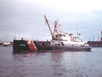 White Heath |
Bothner, M.H., Buchholtz ten Brink, M.R., Butman, B., Knebel, H.J., Manheim, F.T., and Signell, R.P., 1994, Circulation and contaminant transport in Massachusetts coastal waters—A summary of achievements and future plans: U.S. Geological Survey Open-File Report 94-649, https://doi.org/10.3133/ofr94649.
Bothner, M.H., and Butman, Bradford (eds.), 2007, Processes influencing the transport and fate of contaminated sediments in the coastal ocean—Boston Harbor and Massachusetts Bay: U.S. Geological Survey Circular 1302, 89 p., https://doi.org/10.3133/cir1302.
Butman, B., and Bothner, M.H., 1998, Predicting the long-term fate of sediments and contaminants in Massachusetts Bay: U.S. Geological Survey Fact Sheet 172-97, https://doi.org/10.3133/fs17297.
Butman, B., Bothner, M.H., Alexander, P.S., Lightsom, F.L., Martini, M.A., Gutierrez, B.T., and Strahle, W.S., 2004, Long-term oceanographic observations in western Massachusetts Bay offshore of Boston, Massachusetts; data report for 1989-2002: U.S. Geological Survey Digital Data Series DDS-74, Version 2.0, DVD-ROM, URL: https://doi.org/10.3133/ds74_v2.
Butman, B., Bothner, M.H., Hathaway, J.C., Jenter, H.L., Knebel, H.J., Manheim, F.T., and Signell, R.P., 1992, Contaminant transport and accumulation in Massachusetts Bay and Boston Harbor—A summary of U.S. Geological Survey studies: U.S. Geological Survey Open-File Report 92-202, https://doi.org/10.3133/ofr92202.
Butman, B., Dalyander, P.S., Bothner, M.H., Borden, J., Casso, M.A., Gutierrez, B.T., Hastings, M.E., Lightsom, F.L., Martini, M.A., Montgomery, E.T., Rendigs, R.R., and Strahle, W.S., 2009, Long-term oceanographic observations in Massachusetts Bay, 1989 - 2006 (version 3): U.S. Geological Survey Data Series 74, https://doi.org/10.3133/ds74.
Butman, B., Dalyander, P.S., Bothner, M.H., and Lang, W.N., 2008, Time-series photographs of the sea floor in western Massachusetts Bay, version 2, 1989 - 1996: U.S. Geological Survey Data Series 265, https://doi.org/10.3133/ds265.
Hotchkiss, F.S., and Signell, R.P., 1991, Average near-bottom currents in Massachusetts Bay and Cape Cod Bay measured with Woodhead drifters; progress report for drifters released Sept. 1990 through May 1991: U.S. Geological Survey Open-File-Report 91-361, 14 p., URL: https://doi.org/10.3133/ofr91361.
Warner, J.C., Butman, B., and Dalyander, P. S., 2008, Storm-driven sediment transport in Massachusetts Bay: Continental Shelf Research, v. 28 no. 2, doi: 10.1016/j.csr.2007.08.008.
Warner, J.C., Sherwood, Christopher R., Signell, Richard P., Harris, Courtney K., and Arango, Hernan G., 2008, Development of a three-dimensional, regional, coupled wave, current, and sediment-transport model: Computers and Geosciences, v. 34 no. 10, doi: 10.1016/j.cageo.2008.02.012.
| Title | Survey Equipment | Description |
|---|---|---|
| Pre-cruise report | (document not focused on specific equipment) | Chief Scientist's pre-cruise report including personnel, purpose, work plan, equipment, and data to be collected. |
| Survey Equipment | Survey Info | Data Type(s) | Data Collected |
|---|---|---|---|
| Slow corer | --- | Geology | |
| Van Veen grab sampler | --- | Geology | |
| Gravity corer | --- | Geology | 1990-041-FA-SC-001 (CORE, TRAP samples) |
| Sediment traps | --- | Geology | |
| Loran-C | --- | Navigation | |
| Camera- deep sea | --- | Photo | 1990-041-FA-PH-001 (film collection of TRIPOD 358; 19901024-19910221) |
| Raytheon radar | --- | Navigation | |
| Bottom platform | --- | Mooring (physical oceanography) | 1990-041-FA-OM-001 (Western Mass Bay mooring data) |
