Other ID: Erda 90-1_HC, Erda 90-1_PBP, Erda 91-3
Status: Completed
Organization(s): USGS, St. Petersburg Coastal and Marine Science Center
Funding Program(s):
Principal Investigator(s): James Flocks, Jack Kindinger
Affiliate Investigator(s):
Information Specialist(s): Stephen Bosse, Arnell Forde
Data Type(s): Location-Elevation: Navigation, Seismics: Boomer
Scientific Purpose/Goals: To collect geophysical and sedimentological data in the northern Gulf of Mexico, including shallow subsurface data in the form of high-resolution seismic-reflection profiles (HRSP).
Vehicle(s): Unknown
Start Port/Location: St.Petersburg, FL
End Port/Location: St.Petersburg, FL
Start Date: 1990-06-04
End Date: 1991-09-23
Equipment Used: Benthos Mesh Hydrophones with Triton Elics SBLogger, Long range navigation (LORAN), ORE Geopulse
Information to be Derived: Sub-bottom profile images
Summary of Activity and Data Gathered: Collected approximately 443.09 line-kilometers of analog seismic data.
Staff: Jack Kindinger
Affiliate Staff:
Notes: The Erda 90-1 geophysical cruise was conducted in two legs. The first leg included seismic data collected from the Hancock County region of the Mississippi Sound (Erda 90-1_HC) from June 4 to June 6, 1990. The second leg included seismic data collected from the Petit Bois Pass area of Mississippi Sound (Erda 90-1_PBP) from June 8 to June 9, 1990. The Erda 91-3 cruise occurred between September 12 and September 23, 1991, and surveyed the Mississippi Sound region just west of Horn Island, Mississippi.
Location:
Mississippi Sound
| Boundaries | |||
|---|---|---|---|
| North: 30.36147072 | South: 30.16058043 | West: -89.81872559 | East: -87.88098145 |
Platform(s):
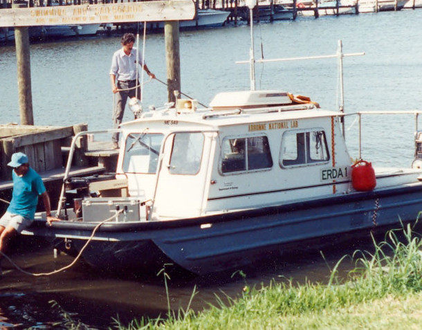 Erda-1 |
Bosse, S.T., Flocks, J.G., Forde, A.S., 2017, Archive of digitized analog Boomer seismic-reflection data collected during U.S. Geological Survey Cruises Erda 90-1_HC, Erda 90-1_PBP, and Erda 91-3 in Mississippi Sound, June 1990 and September 1991: U.S. Geological Survey data release, https://doi.org/10.5066/F7BV7DRT.
Bosse, S.T., Flocks, J.G., Forde, A.S., 2017, Digitized analog boomer seismic-reflection data collected during U.S. Geological Survey cruises Erda 90-1_HC, Erda 90-1_PBP, and Erda 91-3 in Mississippi Sound, June 1990 and September 1991: U.S. Geological Survey Data Series 1047, https://doi.org/10.3133/ds1047.
Gal, N.S., Wallace, D.J., Miner, M.D., Hollis, R.J., Dike, C., Flocks, J.G., 2021, Influence of antecedent geology on the Holocene formation and evolution of Horn Island, Mississippi, USA: Marine Geology, v. 431, 106375 p., doi: 10.1016/j.margeo.2020.106375.
| Survey Equipment | Survey Info | Data Type(s) | Data Collected |
|---|---|---|---|
| Benthos Mesh Hydrophones with Triton Elics SBLogger | --- | Air Gun / Water Gun Boomer Bubble Gun Sparker | Profileswithheaders_Erda_90-1_PBP.zip (Printable seismic profiles with headers regarding the line and survey including cruise specific information, line specific information, and scanning information ) SEGY_Erda_90-1_HC.zip (Society of Exploration Geophysicists open file format that can be accessed by all major seismic data processing and interpretation systems) SEGY_Erda_91-3.zip (Society of Exploration Geophysicists open file format that can be accessed by all major seismic data processing and interpretation systems ) SEGY_Erda_90-1_PBP.zip (Society of Exploration Geophysicists open file format that can be accessed by all major seismic data processing and interpretation systems) Profileswithheaders_Erda_90-1_HC.zip (Printable seismic profiles with headers regarding the line and survey including cruise specific information, line specific information, and scanning information) Profileswithheaders_Erda_91-3.zip (Printable seismic profiles with headers regarding the line and survey including cruise specific information, line specific information, and scanning information) |
| Long range navigation (LORAN) | --- | Navigation | Navigation_Erda_90-1_HC.zip (Cruise specific navigation that was collected using a LORAN system) Navigation_Erda_90-1_PBP.zip (Cruise specific navigation that was collected using a LORAN system) Navigation_Erda_91-3.zip (Cruise specific navigation that was collected using a LORAN system) |
| ORE Geopulse | --- | Boomer Sub Bottom Profiler |
