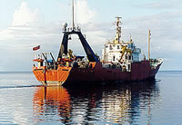
Other ID: F11-91-HW
Status: Completed
Organization(s): USGS, Woods Hole Coastal and Marine Science Center
Funding Program(s):
Principal Investigator(s): William Schwab
Affiliate Investigator(s): Homa Lee, Michael Torresan - Menlo Park
Information Specialist(s):
Data Type(s): Imagery: Photo, Location-Elevation: Navigation, Sampling: Biology, Sampling: Geology, Sonar: Sidescan
Scientific Purpose/Goals: Investigate mass wasting processes on 2 scales: 1) volcanoclastic flows and lava delta failures related to the present Kupaianaha and 1969-1974 Mauna Ulu eruptions; and 2) the giant Alika Debris Avalanche and South Kona Slump off the west coast. Expect 7 days off Kilauea, 3 days off the west coast and 2 day transit. If sea or bottom conditions off Kilauea prevent us from operating effectively, we will devote more time to the west coast. We will obtain 3 dredge hauls on Puna Ridge. All core samples will be assessed for density, sound velocity and magnetic susceptibility using the Schultheiss Multi-Sensor Whole Core Logger prior to splitting. Box core samples will be subsampled and slabbed. Gravity and piston cores will be split, described and tested for vane shear strength and water content. Mass physical properties will be used to calculate downcore variations in acoustic impedance to use in interpreting acoustic backscatter variations on the GLORIA and MR1 mosaics. We will run high-resolution acoustic profiles off Kilauea in a 6 mile grid from Kaimu to Mamoamoa along with bottom camera runs to define coring stations.
Vehicle(s):
Start Port/Location: Honolulu, HI
End Port/Location: Honolulu, HI
Start Date: 1991-11-15
End Date: 1991-11-27
Equipment Used: Gravity corer, Piston corer, Box corer, Van Veen grab sampler, Shipek grab, Dredge, Digital camera, Q-MIPS sidescan sonar system, DGPS
Information to be Derived: Sea floor map;
Summary of Activity and Data Gathered: Cores, dredges, photos, video transects, gravity, magnetics, and bathymetry (3.5 kHz, 10 kHz) data.
Staff: William Schwab, William Winters
Affiliate Staff:
Menlo Park: Homa Lee
Co-Chief Sci.; Michael Torreson
Co-Chief Sci.
Notes: No cruise report; information derived from pre-field work reports and field logs.
Information from Foghorn: Box, gravity and piston corers; Soutar-Van Veen sampler; regular Van Veen and Shipek samplers; dredge; Schultheiss Multi-Sensor Whole Core Logger; cameras; video
Location:
east Flank Kilauea, Alika Debris Avalanche, south Kona slump, west coast Hawaii, Hawaii, United States, North America, North Pacific;
| Boundaries | |||
|---|---|---|---|
| North: 21.45 | South: 18.7 | West: -158.05 | East: -154.35 |
Platform(s):
 Farnella |
| Title | Survey Equipment | Description |
|---|---|---|
| Sample log | (document not focused on specific equipment) | Box and push core log with visual description, some processing notes. |
| Survey Equipment | Survey Info | Data Type(s) | Data Collected |
|---|---|---|---|
| Gravity corer | --- | Geology | |
| Piston corer | --- | Geology | |
| Box corer | --- | Biology Geology | |
| Van Veen grab sampler | --- | Geology | 1991-039-FA-SC-001 (GRAB samples) |
| Shipek grab | --- | Geology | |
| Dredge | --- | Biology Geology | |
| Digital camera | --- | Photo | |
| Q-MIPS sidescan sonar system | --- | Sidescan | |
| DGPS | --- | Navigation |