Other ID: F91-12-HW
Status: Completed
Organization(s): USGS, Woods Hole Coastal and Marine Science Center
Funding Program(s):
Principal Investigator(s): William Danforth, Thomas O'Brien
Affiliate Investigator(s): Michael Torresan/Alexander Shor - U HI (SOEST)
Information Specialist(s):
Data Type(s): Location-Elevation: Navigation, Sonar: Sidescan, Sonar: Single Beam
Scientific Purpose/Goals: Test University of Hawaii MR1 prototype 30 kHz sidescan system off coast of Hawaii (Island).
Vehicle(s):
Start Port/Location: Honolulu, HI
End Port/Location: HI
Start Date: 1991-12-03
End Date: 1991-12-11
Equipment Used: 10 kHz Bathymetry, 12 kHz, Loran-C, Sidescan sonar
Information to be Derived: Sea floor map;
Summary of Activity and Data Gathered: Sidescan system did not perform; collected 10/12 kHz data.
Staff: William Danforth, Thomas O'Brien
Affiliate Staff:
Michael Torresan - co-Chief Scientist - USGS-Menlo; Alexander Shor - co-Chief Scientist - U HI
Notes: No post-cruise report; developed from notes. Original Center People field contained: Tom O'Brien - navigator, William Danforth - watchstander.
Added the echosounders to agree with other information in the field activity.
Location:
east flank of Kilauea, west Kona coast, Hawaii, United States, North America, North Pacific;
| Boundaries | |||
|---|---|---|---|
| North: 21.4 | South: 18.55 | West: -157.9 | East: -154.59 |
Platform(s):
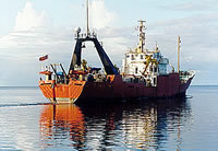
 Farnella |
| Survey Equipment | Survey Info | Data Type(s) | Data Collected |
|---|---|---|---|
| 10 kHz Bathymetry | --- | Single Beam | |
| 12 kHz | --- | Single Beam | |
| Loran-C | --- | Navigation | 1991-044-FA-LN-001 (Navigation data) |
| Sidescan sonar | System did not perform | Sidescan | No data was collected |