Other ID: KJ92-1
Status: Completed
Organization(s): USGS, St. Petersburg Coastal and Marine Science Center
Funding Program(s):
Principal Investigator(s): James Flocks
Affiliate Investigator(s):
Information Specialist(s): Arnell Forde
Data Type(s): Seismics: Boomer
Scientific Purpose/Goals: To investigate the shallow geologic framework along the Florida shelf near Pensacola Beach, St. Joseph Bay aquatic Preserve, and St. George Island
Vehicle(s): Unknown
Start Port/Location: St.Petersburg, FL
End Port/Location: St.Petersburg, FL
Start Date: 1992-07-07
End Date: 1992-07-19
Equipment Used: Huntec ESU-PSU, Benthos Mesh Hydrophones with Triton Elics SBLogger
Information to be Derived: Sub-bottom profiles
Summary of Activity and Data Gathered: Scanned images (.tif) of analog seismic profiles, navigation and GIS files.
Staff: James Flocks
Affiliate Staff:
Notes: Entries for this field activity are based on entries from Field Activity 1992-300-FA
Location:
Florida Shelf
| Boundaries | |||
|---|---|---|---|
| North: 30.35465702 | South: 29.1244979 | West: -86.3512516 | East: -84.22513962 |
Platform(s):
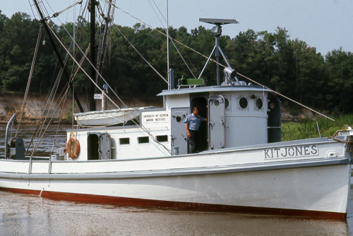 Kit Jones |
Bosse, S.T., Flocks, J.G., Forde, A.S., 2018, Archive of digitized analog boomer seismic reflection data collected during USGS cruise Kit Jones 92-1 along the Florida shelf, July 1992: U.S. Geological Survey data release, https://doi.org/10.5066/P9L3W3MX.
| Survey Equipment | Survey Info | Data Type(s) | Data Collected |
|---|---|---|---|
| Huntec ESU-PSU | --- | Boomer Sub Bottom Profiler | |
| Benthos Mesh Hydrophones with Triton Elics SBLogger | --- | Air Gun / Water Gun Boomer Bubble Gun Sparker | KJ92-1_ProfilesWithScales.zip (Processed seismic profile images with axis scales and headers) KJ92-1_SEGY.zip (Society of Exploration Geophysicists formatted seismic data) KJ92-1_Navigation.zip (Cruise navigation data) KJ92-1_CruiseShapefiles.zip (Cruise shapefiles) KJ92-1_ProfilesWithHeaders.zip (Printable seismic profiles with headers containing cruise, line, and scanning information) |
