Other ID: 9409; FERL9409
Status: Completed
Organization(s): USGS, Woods Hole Coastal and Marine Science Center
Funding Program(s):
Principal Investigator(s): Page Valentine
Affiliate Investigator(s):
Information Specialist(s):
Data Type(s): Sampling: Geology, Imagery: Photo, Imagery: Video, Sonar: Sidescan, Sonar: Single Beam, Location-Elevation: Navigation
Scientific Purpose/Goals: Document character/distribution of fisheries habitats in SE Stellwagen Bank w/ sidescan sonar, video, photo, and samples. Resurvey/sample areas surveyed April and Sep. 1993 to evaluate changes in dredge disturbance on sea bed; prepare sediment distribution/bio habitat maps.
Vehicle(s):
Start Port/Location: Woods Hole, MA
End Port/Location: Woods Hole, MA
Start Date: 1994-10-11
End Date: 1994-10-25
Equipment Used: Van Veen grab sampler, Osprey camera system, Klein 595 100/500kHz sidescan sonar, Benthos fish tracking system, DGPS
Information to be Derived:
Summary of Activity and Data Gathered: Previous cruises have imaged the southwestern part of Stellwagen Bank. This cruise expanded sidescan sonar coverage to the east. Bottom sediment is coarse sand and gravel on the southeastern part of the bank, and it is the source of the sand that is moved westward during large storms from the northeast. Several sidescan lines that were surveyed in April and September 1993 were resurveyed on this cruise. The distribution of storm deposits has not changed since the earlier surveys, and no large nor'easters have occurred since December 1992. These observations support the hypothesis that the bank surface is unaffected by tidal currents and minor storms. Large storms and fishing gear (dredges and trawls) apparently are the major causes of habitat disturbance on the bank.
Staff: Dann Blackwood, Page Valentine, Kenneth F. Parolski, Eric A. Schmuck
Affiliate Staff:
Notes: Field work conducted in two parts: October 11-16 and October 23-25.
Project = Sea floor habitat mapping, Sea floor habitat mapping
Location:
Stellwagen Bank National Marine Sanctuary, United States, North America, North Atlantic;
| Boundaries | |||
|---|---|---|---|
| North: 42.2627 | South: 42.16787 | West: -70.3925 | East: -70.1826 |
Platform(s):
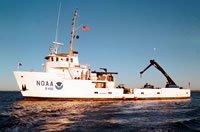 Ferrel |
Valentine, P.C., Baker, J.L., Unger, T.S., Scully, L.A., and Fuller, S.J., 2005, Sea floor image maps showing topography, sun-illuminated topography, backscatter intensity, ruggedness, slope, and the distribution of boulder ridges and bedrock outcrops in the Stellwagen Bank National Marine Sanctuary region off Boston, Massachusetts: U.S. Geological Survey Scientific Investigations Map 2840, https://doi.org/10.3133/sim2840.
Valentine, P.C., and Cross, V.A., 2024, Geospatial datasets of seabed topography, sediment mobility, and the distribution of geologic substrates in quadrangle 2 of the Stellwagen Bank National Marine Sanctuary region offshore of Boston, Massachusetts: U.S. Geological Survey data release, https://doi.org/10.5066/P9UL3LWN.
Valentine, P.C., and Cross, V.A., 2023, Geospatial datasets of seabed topography, sediment mobility, and the distribution of geologic substrates in quadrangle 5 of the Stellwagen Bank National Marine Sanctuary region offshore of Boston, Massachusetts: U.S. Geological Survey data release, https://doi.org/10.5066/P9W9BN3S.
Valentine, P.C., and Gallea, L.B., 2015, Seabed maps showing topography, ruggedness, backscatter intensity, sediment mobility, and the distribution of geologic substrates in quadrangle 6 of the Stellwagen Bank National Marine Sanctuary region offshore of Boston, Massachusetts: U.S. Geological Survey Scientific Investigations Map 3341, 10 sheets, scale 1:25,000, and 21-p. pamphlet, https://doi.org/10.3133/sim3341.
Valentine, P.C., Gallea, L.B., Blackwood, D.S., and Twomey, E.R., 2010, Seabed photographs, sediment texture analyses, and sun-illuminated sea floor topography in the Stellwagen Bank National Marine Sanctuary region off Boston, Massachusetts: U.S. Geological Survey Data Series 469, available at https://doi.org/10.3133/ds469.
| Title | Survey Equipment | Description |
|---|---|---|
| Cruise report | (document not focused on specific equipment) | Chief Scientist's report including personnel, purpose, equipment, tabulated information, preliminary results, station locations and data acquired at the station, trackmap. |
| Survey Equipment | Survey Info | Data Type(s) | Data Collected |
|---|---|---|---|
| Van Veen grab sampler | --- | Geology | 1994-004-FA-SC-001 (GRAB samples) |
| Osprey camera system | --- | Photo Video | 1994-004-FA-PH-001 (CD ROM disk of BOTTOMPHOTO STELL JD284, BOTTOMPHOTO STELL ROV) |
| Klein 595 100/500kHz sidescan sonar | --- | Sidescan | |
| Benthos fish tracking system | --- | Single Beam | |
| DGPS | --- | Navigation |
