Other ID: 9401; ARGO9401
Status: Completed
Organization(s): USGS, Woods Hole Coastal and Marine Science Center
Funding Program(s):
Principal Investigator(s): Page Valentine
Affiliate Investigator(s): Peter Auster - NURP/UCONN
Information Specialist(s):
Data Type(s): Imagery: Photo, Imagery: Video, Location-Elevation: Navigation, Sampling: Geology
Scientific Purpose/Goals: ROV survey, sampling, video observations of sedimentary environments and habitats.
Vehicle(s):
Start Port/Location: Woods Hole, MA
End Port/Location: Gloucester, MA
Start Date: 1994-09-08
End Date: 1994-09-13
Equipment Used: ROV, DGPS, Van Veen grab sampler, Osprey camera system
Information to be Derived: Grain size analysis; Habitat maps;
Summary of Activity and Data Gathered: Sediment samples: 73; Video transects; Bottom photos: 106 images on 1 photo CD.
Staff: Christopher F. Polloni, Page Valentine, Brenton B. Taylor, Eric A. Schmuck
Affiliate Staff:
Peter Auster
associates - NURP/UCONN
Notes: Field activity information derived from pre-cruise report and photo CDs.
Location:
Stellwagen Bank, Massachusetts, United States, North America, North Atlantic;
| Boundaries | |||
|---|---|---|---|
| North: 42.26912306 | South: 42.14671851 | West: -70.39063313 | East: -70.12711903 |
Platform(s):
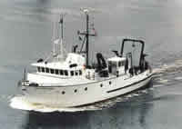 Argo Maine |
Valentine, P.C., Baker, J.L., Unger, T.S., Scully, L.A., and Fuller, S.J., 2005, Sea floor image maps showing topography, sun-illuminated topography, backscatter intensity, ruggedness, slope, and the distribution of boulder ridges and bedrock outcrops in the Stellwagen Bank National Marine Sanctuary region off Boston, Massachusetts: U.S. Geological Survey Scientific Investigations Map 2840, https://doi.org/10.3133/sim2840.
Valentine, P.C., and Cross, V.A., 2024, Geospatial datasets of seabed topography, sediment mobility, and the distribution of geologic substrates in quadrangle 2 of the Stellwagen Bank National Marine Sanctuary region offshore of Boston, Massachusetts: U.S. Geological Survey data release, https://doi.org/10.5066/P9UL3LWN.
Valentine, P.C., and Cross, V.A., 2023, Geospatial datasets of seabed topography, sediment mobility, and the distribution of geologic substrates in quadrangle 5 of the Stellwagen Bank National Marine Sanctuary region offshore of Boston, Massachusetts: U.S. Geological Survey data release, https://doi.org/10.5066/P9W9BN3S.
Valentine, P.C., and Gallea, L.B., 2015, Seabed maps showing topography, ruggedness, backscatter intensity, sediment mobility, and the distribution of geologic substrates in quadrangle 6 of the Stellwagen Bank National Marine Sanctuary region offshore of Boston, Massachusetts: U.S. Geological Survey Scientific Investigations Map 3341, 10 sheets, scale 1:25,000, and 21-p. pamphlet, https://doi.org/10.3133/sim3341.
Valentine, P.C., Gallea, L.B., Blackwood, D.S., and Twomey, E.R., 2010, Seabed photographs, sediment texture analyses, and sun-illuminated sea floor topography in the Stellwagen Bank National Marine Sanctuary region off Boston, Massachusetts: U.S. Geological Survey Data Series 469, available at https://doi.org/10.3133/ds469.
| Survey Equipment | Survey Info | Data Type(s) | Data Collected |
|---|---|---|---|
| ROV | --- | Photo Video Biology Geology | |
| DGPS | --- | Navigation | |
| Van Veen grab sampler | --- | Geology | 1994-014-FA-SC-001 (GRAB samples) |
| Osprey camera system | --- | Photo Video | 1994-014-FA-NL-001 (CD ROM disk of BOTTOMPHOTO STELL JD253, BOTTOMPHOTO STELL JD253, ) 1994-014-FA-PH-001 (CD ROM disk of BOTTOMPHOTO STELL JD253, BOTTOMPHOTO STELL JD253, ) |
