Other ID: 94-2
Status: Completed
Organization(s): USGS, Woods Hole Coastal and Marine Science Center
Funding Program(s):
Principal Investigator(s): Marinna Martini
Affiliate Investigator(s):
Information Specialist(s):
Data Type(s): Environmental Data: Current, Location-Elevation: Navigation, Time Series: Mooring (physical oceanography)
Scientific Purpose/Goals: Deploy tripod #438 to accompany existing moorings at site.
Vehicle(s):
Start Port/Location: Boston, MA
End Port/Location: Boston, MA
Start Date: 1994-04-04
End Date: 1994-04-04
Equipment Used: GPS (wh), ADCP, Bottom platform
Information to be Derived: Time series data;
Summary of Activity and Data Gathered: Mooring deployed: 1 (#438, recovered WHITE HEATH FA 94022 Jun. 7-8, 1994).
Staff: Marinna Martini
Affiliate Staff:
Notes: Project = Massachusetts Bay/Boston Harbor Long-term Monitoring, Massachusetts Bay/Boston Harbor Long-term Monitoring
Location:
Boston Harbor, LNB Buoy, Massachusetts, United States, North America, North Atlantic;
| Boundaries | |||
|---|---|---|---|
| North: 42.4 | South: 42.35 | West: -70.8 | East: -70.75 |
Platform(s):
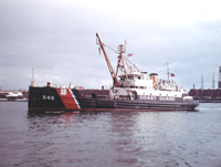 White Heath |
Bothner, M.H., and Butman, Bradford (eds.), 2007, Processes influencing the transport and fate of contaminated sediments in the coastal ocean—Boston Harbor and Massachusetts Bay: U.S. Geological Survey Circular 1302, 89 p., https://doi.org/10.3133/cir1302.
Butman, B., Bothner, M.H., Alexander, P.S., Lightsom, F.L., Martini, M.A., Gutierrez, B.T., and Strahle, W.S., 2004, Long-term oceanographic observations in western Massachusetts Bay offshore of Boston, Massachusetts; data report for 1989-2002: U.S. Geological Survey Digital Data Series DDS-74, Version 2.0, DVD-ROM, URL: https://doi.org/10.3133/ds74_v2.
Butman, B., Dalyander, P.S., Bothner, M.H., Borden, J., Casso, M.A., Gutierrez, B.T., Hastings, M.E., Lightsom, F.L., Martini, M.A., Montgomery, E.T., Rendigs, R.R., and Strahle, W.S., 2009, Long-term oceanographic observations in Massachusetts Bay, 1989 - 2006 (version 3): U.S. Geological Survey Data Series 74, https://doi.org/10.3133/ds74.
| Title | Survey Equipment | Description |
|---|---|---|
| Cruise report | (document not focused on specific equipment) | Chief Scientist's report including personnel, purpose, equipment, station information. |
| Survey Equipment | Survey Info | Data Type(s) | Data Collected |
|---|---|---|---|
| GPS (wh) | --- | Navigation | |
| ADCP | --- | Current | |
| Bottom platform | --- | Mooring (physical oceanography) | 1994-035-FA-OM-001 (Western Mass Bay mooring data) |
