Other ID: none
Status: Completed
Organization(s): USGS, Woods Hole Coastal and Marine Science Center
Funding Program(s):
Principal Investigator(s): David Nichols
Affiliate Investigator(s): Terry Edgar - Reston; Yusuf Djajadihardja - BPPT
Information Specialist(s):
Data Type(s): Seismics: Air Gun / Water Gun, Seismics: Boomer, Seismics: Sparker, Location-Elevation: Navigation
Scientific Purpose/Goals: Conduct a north-south high-resolution seismic line from the northern Arafura Sea to the southern-most part of the Gulf of Carpentaria that lies in Indonesian waters to investigate glacially related climate fluctuations in the tropics.
Vehicle(s):
Start Port/Location: Jakarta, Indonesia
End Port/Location: Merauke, Indonesia
Start Date: 1995-10-20
End Date: 1995-10-31
Equipment Used: Water gun (wh), Seismic Engineering streamer, GPS (wh)
Information to be Derived: Morphology;
Summary of Activity and Data Gathered: Digitalizing computer failed; analog data only. 3 Watergun lines: 765 km.
Staff: David Nichols
Affiliate Staff:
Terence Edgar - Co-Ch. Sci. - Reston; Blaine Cecil - geologist - Reston; Robert Mattick - geophysicist - Reston; Yusuf Djajadihardja - Co-Ch. Sci. - BPPT; Udrech Utt - geophysicist; Dini Pierbani - geologist; Nova Subiyanto - geophysicist; Rita Mardelira - geophysicist
Notes: Original Center People field contained: Dave Nichols - seismic specialist.
Project = Geology Epicontinental Systems - SE Asia, Australia, Geology Epicontinental Systems - SE Asia, Australia
Location:
Arafura Sea, Gulf of Carpentaria, Indonesia, Indian Ocean;
| Boundaries | |||
|---|---|---|---|
| North: -4.8355557 | South: -10.81891831 | West: 135.96196127 | East: 140.39297199 |
Platform(s):
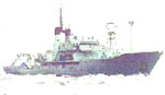 Baruna Jaya III |
| Title | Survey Equipment | Description |
|---|---|---|
| Cruise report | (document not focused on specific equipment) | Chief scientist's cruise report including personnel, purpose, equipment, tabulated information, seismic line location and analog tape list. |
| Navigation log | GPS (wh) | GPS navigation log containing line times, position, acquisition notes |
| Navigation log | GPS (wh) | GPS navigation printout with tape notes. |
| Seismic log | Water gun (wh) | Seismic log containing line numbers, times, positions, tape numbers, and system notes. |
| Data inventory | (document not focused on specific equipment) | Inventory of field data. |
| Survey Equipment | Survey Info | Data Type(s) | Data Collected |
|---|---|---|---|
| Water gun (wh) | --- | Air Gun / Water Gun | |
| Seismic Engineering streamer | --- | Air Gun / Water Gun Boomer Sparker | 1995-003-FA-SE-001-03 (Line 3 SEG-Y data file (223.9 MB)) 1995-003-FA-SE-001-02 (Line 2 SEG-Y data file (219.1 MB)) 1995-003-FA-SE-001-01 (Line 1 SEG-Y data file (160.1 MB)) 1995-003-FA-SE-001 (CD ROM disk of H2OGUN / L1-3, SEGY, ) |
| GPS (wh) | --- | Navigation | 1995-003-FA-LN-001-01 (Cruise track chart.) 1995-003-FA-LN-001-05 (Edited GPS navigation for Line 3.) 1995-003-FA-LN-001-04 (Edited GPS navigation for Line 2.) 1995-003-FA-LN-001-02 (Edited GPS navigation for test line.) 1995-003-FA-LN-001-03 (Edited GPS navigation for Line 1.) |
