Other ID: none
Status: Completed
Organization(s): USGS, Woods Hole Coastal and Marine Science Center
Funding Program(s):
Principal Investigator(s): William J. Strahle
Affiliate Investigator(s):
Information Specialist(s):
Data Type(s): Location-Elevation: Navigation, Time Series: Mooring (physical oceanography)
Scientific Purpose/Goals: Recover surface mooring #448 on Stellwagen Basin and attach surface marker to subsurface mooring #452 in Greater Boston Harbor.
Vehicle(s):
Start Port/Location: Boston, MA
End Port/Location: Boston, MA
Start Date: 1995-04-10
End Date: 1995-04-10
Equipment Used: GPS (wh), Bottom platform
Information to be Derived: Time series data;
Summary of Activity and Data Gathered: Moorings recovered: 1 (#448 deployed FA 94048 WHITE HEATH Oct. 25, 1994).
Staff: Dann Blackwood, Marinna Martini, Joseph S. Newell
Affiliate Staff:
Steve Cross - WHOI
Notes: Project = Greater Boston Harbor, Greater Boston Harbor
Location:
Greater Boston Harbor, Stellwagen Bank, Massachusetts, United States, North America, North Atlantic;
| Boundaries | |||
|---|---|---|---|
| North: 42.4 | South: 42.25 | West: -70.8 | East: -70.15 |
Platform(s):
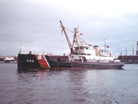 White Heath |
Bothner, M.H., and Butman, Bradford (eds.), 2007, Processes influencing the transport and fate of contaminated sediments in the coastal ocean—Boston Harbor and Massachusetts Bay: U.S. Geological Survey Circular 1302, 89 p., https://doi.org/10.3133/cir1302.
Warner, J.C., Butman, B., and Dalyander, P. S., 2008, Storm-driven sediment transport in Massachusetts Bay: Continental Shelf Research, v. 28 no. 2, doi: 10.1016/j.csr.2007.08.008.
Warner, J.C., Sherwood, Christopher R., Signell, Richard P., Harris, Courtney K., and Arango, Hernan G., 2008, Development of a three-dimensional, regional, coupled wave, current, and sediment-transport model: Computers and Geosciences, v. 34 no. 10, doi: 10.1016/j.cageo.2008.02.012.
| Title | Survey Equipment | Description |
|---|---|---|
| Cruise report | (document not focused on specific equipment) | Chief Scientist's report including personnel, purpose, tabulated information. |
| Survey Equipment | Survey Info | Data Type(s) | Data Collected |
|---|---|---|---|
| GPS (wh) | --- | Navigation | |
| Bottom platform | --- | Mooring (physical oceanography) | 1995-029-FA-OM-001 (Stellwagen mooring data) |
