Other ID: none
Status: Completed
Organization(s): USGS, Woods Hole Coastal and Marine Science Center
Funding Program(s):
Principal Investigator(s): Page Valentine
Affiliate Investigator(s): Jeremy Collie - URI
Information Specialist(s): Page Valentine
Data Type(s): Imagery: Photo, Imagery: Video, Sampling: Geology, Location-Elevation: Navigation
Scientific Purpose/Goals: Video and sample sedimentary environments and biological habitats.
Vehicle(s):
Start Port/Location: Gloucester, MA
End Port/Location: Fairhaven, MA
Start Date: 1996-05-24
End Date: 1996-06-02
Equipment Used: Osprey camera system, DGPS, SeaBOSS
Information to be Derived:
Summary of Activity and Data Gathered:
Staff: Page Valentine
Affiliate Staff:
Jeremy Collie - URI
Notes: Information from Foghorn: Van Veen grab, video, still cameras, blue winch, DGPS and monitor, P-Code navigation;
Location:
Georges Bank, United States, North America, North Atlantic,
| Boundaries | |||
|---|---|---|---|
| North: 43.25934 | South: 41.59267 | West: -70.3041 | East: -68.63741 |
Platform(s):
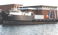 Diane G |
| Survey Equipment | Survey Info | Data Type(s) | Data Collected |
|---|---|---|---|
| Osprey camera system | --- | Photo Video | 1996-026-FA-PH-001 (CD ROM disk of BOTTOMPHOTO GEORGES JD148, BOTTOMPHOTO GEORGES JD148, BOTTOMPHOTO GEORGES JD148, BOTTOMPHOTO GEORGES JD150, ) |
| DGPS | --- | Navigation | |
| SeaBOSS | --- | Surveys (biological) Experiments (biological) Species ID Photo Video Geology Biology |
