Other ID: M-29-96-MB, M2996MB
Status: Completed
Organization(s): USGS, Woods Hole Coastal and Marine Science Center
Funding Program(s):
Principal Investigator(s): William J. Strahle
Affiliate Investigator(s): Steve Eittriem, USGS Andrew Stevenson, USGS
Information Specialist(s): Marinna Martini
Data Type(s): Time Series: Mooring (physical oceanography)
Scientific Purpose/Goals: Recover Monterey Canyon current meter mooring #458 deployed 1995; deploy 5 moorings #472, 473, 474, 475, and 476 on coastal shelf for sediment transport study.
Vehicle(s):
Start Port/Location: Moss Landing, CA
End Port/Location: Moss Landing, CA
Start Date: 1996-08-15
End Date: 1996-08-18
Equipment Used: Bottom platform
Information to be Derived:
Summary of Activity and Data Gathered: Mooring recovered: 1 (#458 deployed FA 95030 MCARTHUR May 15-18, 1995). Moorings deployed: 5 (#472, 473, 474, and 475, recovered FA 97028 POINT SUR Apr. 16-18, 1997; #476 lost).
Staff: Marinna Martini, Joseph S. Newell, Richard Rendigs, William J. Strahle
Affiliate Staff:
Marlene Noble
Kaye Kinoshita - PMG
Notes:
Location:
Monterey Canyon, Davenport, Santa Cruz, California, United States, North America, North Pacific;
| Boundaries | |||
|---|---|---|---|
| North: 37.66643 | South: 36.47431 | West: -122.882 | East: -121.62964 |
Platform(s):
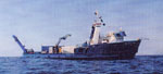 William A. McGaw |
| Survey Equipment | Survey Info | Data Type(s) | Data Collected |
|---|---|---|---|
| Bottom platform | --- | Mooring (physical oceanography) | 1996-029-FA-OM-001 (mooring data) |
