Other ID: none
Status: Completed
Organization(s): USGS, Woods Hole Coastal and Marine Science Center
Funding Program(s):
Principal Investigator(s): Page Valentine
Affiliate Investigator(s): Larry Mayer - NOAA; John Hughes-Clark - UNB
Information Specialist(s):
Data Type(s): Sonar: Multibeam, Location-Elevation: Navigation
Scientific Purpose/Goals: Continue multibeam bathymetric and sidescan sonar survey of Stellwagen Bank NMS.
Vehicle(s):
Start Port/Location: Gloucester, MA
End Port/Location: Gloucester, MA
Start Date: 1996-04-02
End Date: 1996-04-26
Equipment Used: Simrad EM 1000, DGPS
Information to be Derived:
Summary of Activity and Data Gathered: This field activity, originally scheduled for 1995, was rescheduled and concluded in 1996. Information also appears under Field Activity # 95033.
Staff: William Danforth, Page Valentine
Affiliate Staff:
Larry Mayer - NOAA
Eddie Radford - NOS
John Hughes-Clark - UNB
Notes: Original Center People field contained: Page Valentine, Bill Danforth, and others.
Project = Stellwagen Bank NMS Mapping Project, Stellwagen Bank NMS Mapping Project
Location:
Stellwagen Bank region, North America, North Atlantic;
| Boundaries | |||
|---|---|---|---|
| North: 42.8 | South: 42.32 | West: -70.6 | East: -70.03 |
Platform(s):
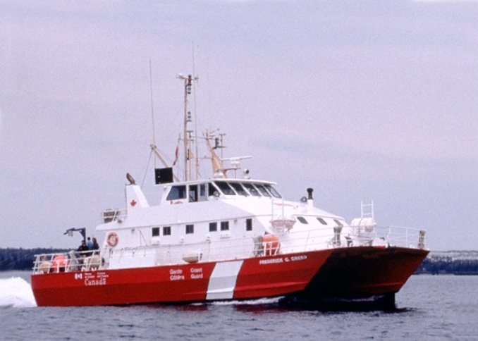 Creed |
Bothner, M.H., and Butman, Bradford (eds.), 2007, Processes influencing the transport and fate of contaminated sediments in the coastal ocean—Boston Harbor and Massachusetts Bay: U.S. Geological Survey Circular 1302, 89 p., https://doi.org/10.3133/cir1302.
Butman, B., Valentine, P.C., Danforth, W.W., Hayes, L., Serrett, L.A., and Middleton, T.J., 2004, Shaded relief, sea-floor topography, and backscatter intensity of Massachusetts Bay and the Stellwagen Bank region offshore of Boston, Massachusetts: U.S. Geological Survey IMAP 2734, https://doi.org/10.3133/i2734.
Butman, B., Valentine, P.C., Middleton, T.J., and Danforth, W.W., 2007, A GIS library of multibeam data for Massachusetts Bay and the Stellwagen Bank National Marine Sanctuary, offshore of Boston, Massachusetts: U.S. Geological Survey Data Series 99, https://doi.org/10.3133/ds99.
Pendleton, E.A., Baldwin, W.E., Barnhardt, W.A., Ackerman, S.D., Foster, D.S., Andrews, B.D., and Schwab, W.C., 2013, Shallow geology, seafloor texture, and physiographic zones of the Inner Continental Shelf from Nahant to northern Cape Cod Bay, Massachusetts: U.S. Geological Survey Open-File Report 2012–1157, 53 p., https://doi.org/10.3133/ofr20121157.
Valentine, P.C., Baker, J., Unger, T., and Polloni, C., 1998, Archive of the SIMRAD EM1000 processed multibeam data collected during the Frederick G. Creed surveys of Stellwagen Bank National Marine Sanctuary, April and December 1996: U.S. Geological Survey Open-File Report 98-49, https://doi.org/10.3133/ofr9849.
Valentine, P.C., Baker, J.L., Unger, T.S., and Polloni, C., 1998, Sea floor topographic map and perspective-view imagery of quadrangles 1-18, Stellwagen Bank National Marine Sanctuary off Boston, Massachusetts: U.S. Geological Survey Open-File Report 98-138, https://doi.org/10.3133/ofr98138.
Valentine, P.C., Baker, J.L., Unger, T.S., Scully, L.A., and Fuller, S.J., 2005, Sea floor image maps showing topography, sun-illuminated topography, backscatter intensity, ruggedness, slope, and the distribution of boulder ridges and bedrock outcrops in the Stellwagen Bank National Marine Sanctuary region off Boston, Massachusetts: U.S. Geological Survey Scientific Investigations Map 2840, https://doi.org/10.3133/sim2840.
Valentine, P.C., and Butman, B., 1998, Mapping the sea-floor and biological habitats of the Stellwagen Bank National Marine Sanctuary region: U.S. Geological Survey Fact Sheet 078-98, https://doi.org/10.3133/fs07898.
Valentine, P.C., and Cross, V.A., 2024, Geospatial datasets of seabed topography, sediment mobility, and the distribution of geologic substrates in quadrangle 2 of the Stellwagen Bank National Marine Sanctuary region offshore of Boston, Massachusetts: U.S. Geological Survey data release, https://doi.org/10.5066/P9UL3LWN.
Valentine, P.C., and Cross, V.A., 2023, Geospatial datasets of seabed topography, sediment mobility, and the distribution of geologic substrates in quadrangle 5 of the Stellwagen Bank National Marine Sanctuary region offshore of Boston, Massachusetts: U.S. Geological Survey data release, https://doi.org/10.5066/P9W9BN3S.
Valentine, P.C., and Gallea, L.B., 2015, Seabed maps showing topography, ruggedness, backscatter intensity, sediment mobility, and the distribution of geologic substrates in quadrangle 6 of the Stellwagen Bank National Marine Sanctuary region offshore of Boston, Massachusetts: U.S. Geological Survey Scientific Investigations Map 3341, 10 sheets, scale 1:25,000, and 21-p. pamphlet, https://doi.org/10.3133/sim3341.
Valentine, P.C., Unger, T.S., Baker, J.L., and Roworth, E.T., 1997, Sea floor topography of Quadrangle 14 in the Stellwagen Bank National Marine Sanctuary off Boston, Massachusetts: U.S. Geological Survey Open-File Report 97-727, scale 1:25,000, https://doi.org/10.3133/ofr97727.
Valentine, P.C., Scully, Lian A., and Fuller, Sarah J., 2005, Sea floor ruggedness in the Stellwagen Bank National Marine Sanctuary region: U.S. Geological Survey Scientific Investigations Map I-2840-D, CD-ROM, URL: http://pubs.usgs.gov/sim/2005/2840/.
Valentine, P.C., Unger, T.S., and Baker, J.L., 2000, Sun-illuminated sea floor topography of Quadrangle 2 in the Stellwagen Bank National Marine Sanctuary off Boston, Massachusetts: U.S. Geological Survey Geologic Investigations Series Map I-2702, URL: https://doi.org/10.3133/i2702.
| Survey Equipment | Survey Info | Data Type(s) | Data Collected |
|---|---|---|---|
| Simrad EM 1000 | --- | Multibeam | |
| DGPS | --- | Navigation |
