Other ID: ISBL9637
Status: Completed
Organization(s): USGS, Woods Hole Coastal and Marine Science Center
Funding Program(s):
Principal Investigator(s): Page Valentine
Affiliate Investigator(s):
Information Specialist(s): Page Valentine
Data Type(s): Location-Elevation: Navigation, Sampling: Geology, Imagery: Photo, Imagery: Video, Environmental Data: CTD
Scientific Purpose/Goals: Sampling, video and still observations of sea bed to ground truth multibeam survey for mapping. CTD casts.
Vehicle(s):
Start Port/Location: Woods Hole, MA
End Port/Location: Woods Hole, MA
Start Date: 1996-07-26
End Date: 1996-08-01
Equipment Used: DGPS, Van Veen grab sampler, Osprey camera system, SBE 9 CTD
Information to be Derived:
Summary of Activity and Data Gathered: Collected sediment samples, video, and CTD data.
Staff: Dann Blackwood, Jane Cookman, Eric Haase, Kathy Hall, Christopher F. Polloni, Nancy K. Soderberg, Sara Stillman, Page Valentine
Affiliate Staff:
Notes:
Project = Stellwagen Bank NMS Mapping Project, Stellwagen Bank NMS Mapping Project
Location:
Stellwagen Bank region, North America, North Atlantic;;
| Boundaries | |||
|---|---|---|---|
| North: 42.63 | South: 42.1 | West: -70.56 | East: -70 |
Platform(s):
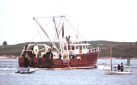 Isabel S |
Valentine, P.C., Baker, J.L., Unger, T.S., Scully, L.A., and Fuller, S.J., 2005, Sea floor image maps showing topography, sun-illuminated topography, backscatter intensity, ruggedness, slope, and the distribution of boulder ridges and bedrock outcrops in the Stellwagen Bank National Marine Sanctuary region off Boston, Massachusetts: U.S. Geological Survey Scientific Investigations Map 2840, https://doi.org/10.3133/sim2840.
Valentine, P.C., and Cross, V.A., 2024, Geospatial datasets of seabed topography, sediment mobility, and the distribution of geologic substrates in quadrangle 2 of the Stellwagen Bank National Marine Sanctuary region offshore of Boston, Massachusetts: U.S. Geological Survey data release, https://doi.org/10.5066/P9UL3LWN.
Valentine, P.C., and Cross, V.A., 2023, Geospatial datasets of seabed topography, sediment mobility, and the distribution of geologic substrates in quadrangle 5 of the Stellwagen Bank National Marine Sanctuary region offshore of Boston, Massachusetts: U.S. Geological Survey data release, https://doi.org/10.5066/P9W9BN3S.
Valentine, P.C., and Gallea, L.B., 2015, Seabed maps showing topography, ruggedness, backscatter intensity, sediment mobility, and the distribution of geologic substrates in quadrangle 6 of the Stellwagen Bank National Marine Sanctuary region offshore of Boston, Massachusetts: U.S. Geological Survey Scientific Investigations Map 3341, 10 sheets, scale 1:25,000, and 21-p. pamphlet, https://doi.org/10.3133/sim3341.
| Survey Equipment | Survey Info | Data Type(s) | Data Collected |
|---|---|---|---|
| DGPS | --- | Navigation | |
| Van Veen grab sampler | --- | Geology | 1996-037-FA-SC-001 (GRAB samples) |
| Osprey camera system | --- | Photo Video | |
| SBE 9 CTD | --- | CTD |
