Other ID: none
Status: Completed
Organization(s): USGS, Woods Hole Coastal and Marine Science Center
Funding Program(s): Other (Other)
Principal Investigator(s): Bradford Butman, William Schwab, Page Valentine
Affiliate Investigator(s): Canadian Hydrographic Service - University of New Brunswick; NOAA, NMSP and NOS
Information Specialist(s): William Danforth
Data Type(s): Location-Elevation: Navigation, Sonar: Multibeam
Scientific Purpose/Goals: Bathymetric and backscatter surveys using multibeam in New York Bight, Stellwagen NMS, and western Massachusetts Bay to outfall region.
Vehicle(s):
Start Port/Location: Woods Hole, MA
End Port/Location: Gloucester, MA
Start Date: 1996-11-19
End Date: 1996-12-14
Equipment Used: Simrad EM 1000, DGPS
Information to be Derived: Sea floor map; bathymetric map; backscatter intensity map
Summary of Activity and Data Gathered: SBNMS: 6 days at sea; 1093 km data.
Staff: VeeAnn Cross, William Danforth, Jane Denny, William Schwab, Page Valentine
Affiliate Staff:
Lt. Tom Jacobs - NOAA
12/3-14; John Hughes-Clark - UNB
11/19-12/?
Notes: Original Submitted By field contained: Brad Butman and Page Valentine.
Project = NY Bight; Stellwagen NMS; Massachusetts Bay, NY Bight; Stellwagen NMS; Massachusetts Bay
Location:
Stellwagen NMS, western Massachusetts Bay, New York Bight, New York, New Jersey, United States, North America, North Atlantic;,
| Boundaries | |||
|---|---|---|---|
| North: 40.52118 | South: 39.59722 | West: -73.8239 | East: -72.01538 |
Platform(s):
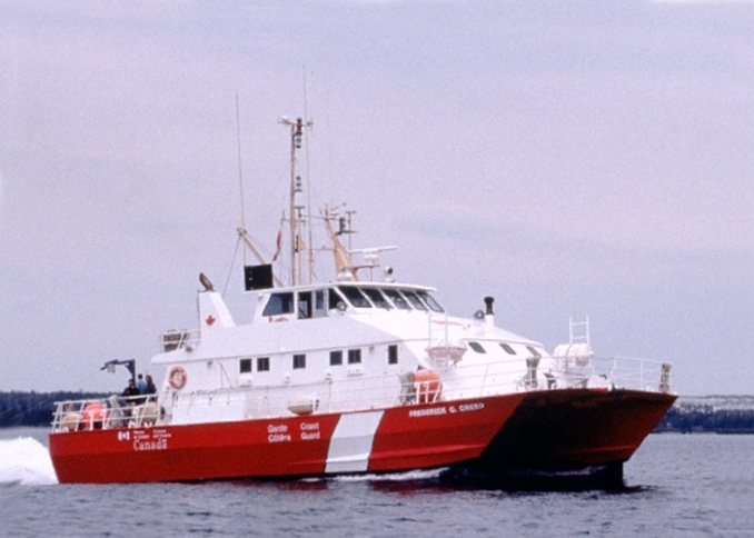 Creed |
Bothner, M.H., and Butman, Bradford (eds.), 2007, Processes influencing the transport and fate of contaminated sediments in the coastal ocean—Boston Harbor and Massachusetts Bay: U.S. Geological Survey Circular 1302, 89 p., https://doi.org/10.3133/cir1302.
Butman, B., 2002, Mapping the sea floor of the Historic Area Remediation Site (HARS) offshore of New York City: U.S. Geological Survey Fact Sheet 001-02, https://doi.org/10.3133/fs00102.
Butman, B., 1998, Mapping the sea-floor geology offshore of the New York - New Jersey metropolitan region: U.S. Geological Survey Fact Sheet 133-98, https://doi.org/10.3133/fs13398.
Butman, B., Danforth, W.W., Hughes Clarke, J.E., and Signell, R.P., 2017, Bathymetry and backscatter intensity of the sea floor of the Historic Area Remediation Site in 1996, 1998, and 2000: U.S. Geological Survey data release, https://doi.org/10.5066/F74B2ZGX.
Butman, B., Danforth, W.W., Hughes Clarke, J.E., and Signell, R.P., 2017, Bathymetry and backscatter intensity of the sea floor of the Hudson Shelf Valley: U.S. Geological Survey data release, https://doi.org/10.5066/F7C53J1Z.
Butman, B., Danforth, W.W., Knowles, S.C., May, B., and Serrett, L., 2002, Sea floor topography and backscatter intensity of the Historic Area Remediation Site (HARS), offshore of New York, based on multibeam surveys conducted in 1996, 1998, and 2000: U.S. Geological Survey Open-File Report 00-503, DVD-ROM, URL: https://doi.org/10.3133/ofr2000503.
Butman, B., Danforth, W.W., Schwab, W.C., and Buchholtz ten Brink, M.R., 1998, Multibeam bathymetric and backscatter maps of the upper Hudson Shelf Valley and adjacent shelf, offshore of New York: U.S. Geological Survey Open-File Report 98-616, https://doi.org/10.3133/ofr98616.
Butman, B., Hayes, L., Danforth, W.W., and Valentine, P.C., 2003, Backscatter intensity, shaded relief, and sea floor topography of Quadrangle 2 in western Massachusetts Bay offshore of Boston, Massachusetts: U.S. Geological Survey IMAP 2732-C, https://doi.org/10.3133/i2732C.
Butman, B., Hayes, L., Danforth, W.W., and Valentine, P.C., 2003, Shaded relief and sea floor topography of quadrangle 1 in western Massachusetts Bay offshore of Boston, Massachusetts: U.S. Geological Survey IMAP 2731-B, https://doi.org/10.3133/i2731B.
Butman, B., Hayes, L., Danforth, W.W., and Valentine, P.C., 2003, Shaded relief and sea floor topography of Quadrangle 2 in western Massachusetts Bay offshore of Boston, Massachusetts: U.S. Geological Survey IMAP 2732-B, https://doi.org/10.3133/i2732B.
Butman, B., Middleton, T.J., Thieler, E.R., and Schwab, W.C., 2003, Topography, shaded relief, and backscatter intensity of the Hudson Shelf Valley, offshore of New York: U.S. Geological Survey Open-File Report 2003-372, CD-ROM, URL: https://doi.org/10.3133/ofr03372.
Butman, B., Valentine, P.C., Middleton, T.J., and Danforth, W.W., 2007, A GIS library of multibeam data for Massachusetts Bay and the Stellwagen Bank National Marine Sanctuary, offshore of Boston, Massachusetts: U.S. Geological Survey Data Series 99, https://doi.org/10.3133/ds99.
Schwab, W.C., Denny, J.F., Foster, D.S., Lotto, L.L., Allison, M.A., Uchupi, E., Swift, B.A., Danforth, W.W., Thieler, E.R., and Butman, B., 2002, High-resolution Quaternary seismic stratigraphy of the New York Bight Continental Shelf: U.S. Geological Survey Open-File Report 2002-152, DVD-ROM, URL: https://doi.org/10.3133/ofr2002152.
Valentine, P.C., Baker, J., Unger, T., and Polloni, C., 1998, Archive of the SIMRAD EM1000 processed multibeam data collected during the Frederick G. Creed surveys of Stellwagen Bank National Marine Sanctuary, April and December 1996: U.S. Geological Survey Open-File Report 98-49, https://doi.org/10.3133/ofr9849.
Valentine, P.C., Baker, J.L., Unger, T.S., Scully, L.A., and Fuller, S.J., 2005, Sea floor image maps showing topography, sun-illuminated topography, backscatter intensity, ruggedness, slope, and the distribution of boulder ridges and bedrock outcrops in the Stellwagen Bank National Marine Sanctuary region off Boston, Massachusetts: U.S. Geological Survey Scientific Investigations Map 2840, https://doi.org/10.3133/sim2840.
Valentine, P.C., and Cross, V.A., 2024, Geospatial datasets of seabed topography, sediment mobility, and the distribution of geologic substrates in quadrangle 2 of the Stellwagen Bank National Marine Sanctuary region offshore of Boston, Massachusetts: U.S. Geological Survey data release, https://doi.org/10.5066/P9UL3LWN.
Valentine, P.C., and Cross, V.A., 2023, Geospatial datasets of seabed topography, sediment mobility, and the distribution of geologic substrates in quadrangle 5 of the Stellwagen Bank National Marine Sanctuary region offshore of Boston, Massachusetts: U.S. Geological Survey data release, https://doi.org/10.5066/P9W9BN3S.
Valentine, P.C., and Gallea, L.B., 2015, Seabed maps showing topography, ruggedness, backscatter intensity, sediment mobility, and the distribution of geologic substrates in quadrangle 6 of the Stellwagen Bank National Marine Sanctuary region offshore of Boston, Massachusetts: U.S. Geological Survey Scientific Investigations Map 3341, 10 sheets, scale 1:25,000, and 21-p. pamphlet, https://doi.org/10.3133/sim3341.
Valentine, P.C., Unger, T.S., Baker, J.L., and Roworth, E.T., 1997, Sea floor topography of Quadrangle 14 in the Stellwagen Bank National Marine Sanctuary off Boston, Massachusetts: U.S. Geological Survey Open-File Report 97-727, scale 1:25,000, https://doi.org/10.3133/ofr97727.
| Survey Equipment | Survey Info | Data Type(s) | Data Collected |
|---|---|---|---|
| Simrad EM 1000 | --- | Multibeam | Hars1996Mos (GeoTIFF image of the backscatter intensity of the sea floor of the Historic Area Remediation Site in 1996 (3-m resolution, Mercator, WGS 84)) Hars1996Pseudo (GeoTIFF image of the shaded-relief bathymetry of the sea floor, colored by backscatter intensity, of the Historic Area Remediation Site in 1996 (3-m resolution, Mercator, WGS 84)) Hars1996Sun (GeoTIFF image of the shaded-relief bathymetry of the Historic Area Remediation Site in 1996 (3-m resolution, Mercator, WGS 84)) HARS1996_3m_bathymetry (Bathymetry of the Historic Area Remediation site in 1996) HSV_12m_backscatter (GeoTIFF image of the backscatter intensity of the sea floor of the Hudson Shelf Valley (12-m resolution, Mercator, WGS 84)) HSV_12m_bathymetry (Bathymetry of the Hudson Shelf Valley (12-m resolution Esri binary grid and 32-bit GeoTIFF, Mercator, WGS 84)) hsv_srback12m (GeoTIFF image of shaded-relief bathymetry, colored by backscatter intensity, of the sea floor of the Hudson Shelf Valley (12-m resolution, Mercator, WGS 84)) hsv_srelief12m (GeoTIFF image of shaded-relief bathymetry of the sea floor of the Hudson Shelf Valley (12-m resolution, Mercator, WGS 84)) Bathymetry GIS data |
| DGPS | --- | Navigation | Hars1996Nav (Tracklines of a multibeam survey of the sea floor in the Historic Area Remediation Site in 1996 (polyline shapefile, geographic, WGS 84)) hsv_1996_nav (Tracklines of a multibeam survey of the Hudson Shelf Valley carried out in 1996 (polyline shapefile, geographic, WGS 84)) |
