Other ID: M-3-97-MB; AR-97-07-3
Status: Completed
Organization(s): USGS, Woods Hole Coastal and Marine Science Center
Funding Program(s):
Principal Investigator(s): William J. Strahle
Affiliate Investigator(s): Marlene Noble - Menlo Park
Information Specialist(s):
Data Type(s): Time Series: Mooring (physical oceanography)
Scientific Purpose/Goals: Recover 4 moorings (#497, 498, 499, and 500) from Monterey Bay and deploy 3 moorings (#504, 505 and 506).
Vehicle(s):
Start Port/Location:
End Port/Location:
Start Date: 1997-09-03
End Date: 1997-09-06
Equipment Used: Bottom platform
Information to be Derived: Time series data;
Summary of Activity and Data Gathered: Moorings recovered: 4 (#497, 498, 499, and 500 all deployed FA 97028 POINT SUR Apr. 16-18, 1997). Moorings deployed: 3 (#504 recovered Jun. 17, 1998, no recovery information; and #505 and 506, both recovered FA 98023 POINT SUR Apr. 1-3, 1998).
Staff:
Affiliate Staff:
Menlo Park: Marlene Noble
Kaye Kinoshita
Holly Ryan
Notes: No personnel from Woods Hole.
Project = Monterey Bay National Marine Sanctuary, Monterey Bay National Marine Sanctuary
Location:
Monterey Bay, Santa Cruz, Davenport, California, United States, North America, North Pacific;
| Boundaries | |||
|---|---|---|---|
| North: 37.03776149 | South: 36.91915604 | West: -122.35109643 | East: -121.9387669 |
Platform(s):
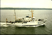 McArthur |
| Survey Equipment | Survey Info | Data Type(s) | Data Collected |
|---|---|---|---|
| Bottom platform | --- | Mooring (physical oceanography) | 1997-053-FA-OM-001 (mooring data) |
